 |
|
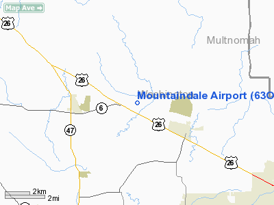
Location & QuickFacts
| FAA Information Effective: | 2008-09-25 |
| Airport Identifier: | 63OR |
| Airport Status: | Operational |
| Longitude/Latitude: | 123-02-44.3840W/45-36-59.4110N
-123.045662/45.616503 (Estimated) |
| Elevation: | 180 ft / 54.86 m (Estimated) |
| Land: | 0 acres |
| From nearest city: | 1 nautical miles SW of Mountaindale, OR |
| Location: | Washington County, OR |
| Magnetic Variation: | 20E (1985) |
Owner & Manager
| Ownership: | Privately owned |
| Owner: | Mountaindale Properties Inc |
| Address: | 3025 Ne 43
Portland, OR 97213 |
| Phone number: | 503-282-9701 |
| Manager: | Clyde E. Deardorff |
| Address: | 1004 Ne 139th Avenue
Vancouver, WA 98684 |
| Phone number: | 206-254-9026 |
Airport Operations and Facilities
| Airport Use: | Private |
| Wind indicator: | Yes |
| Segmented Circle: | No |
| Control Tower: | No |
| Landing fee charge: | No |
| Sectional chart: | Seattle |
| Region: | ANM - Northwest Mountain |
| Boundary ARTCC: | ZSE - Seattle |
| Tie-in FSS: | MMV - Mc Minnville |
| FSS on Airport: | No |
| FSS Toll Free: | 1-800-WX-BRIEF |
Airport Services
| Airframe Repair: | MINOR |
| Power Plant Repair: | MINOR |
Runway Information
Runway 17/35
| Dimension: | 2300 x 100 ft / 701.0 x 30.5 m |
| Surface: | DIRT, |
| |
Runway 17 |
Runway 35 |
| Traffic Pattern: | Left | Left |
|
Radio Navigation Aids
| ID |
Type |
Name |
Ch |
Freq |
Var |
Dist |
| PND | NDB | Banks | | 356.00 | 21E | 0.8 nm |
| LBH | NDB | Laker | | 332.00 | 20E | 25.0 nm |
| LSO | NDB | Kelso | | 256.00 | 21E | 32.9 nm |
| PEN | NDB | Karpen | | 201.00 | 20E | 38.8 nm |
| CBU | TACAN | Columbia | 029X | | 20E | 18.3 nm |
| UBG | VOR/DME | Newberg | 121X | 117.40 | 21E | 16.1 nm |
| PDX | VOR/DME | Portland | 055X | 111.80 | 20E | 18.5 nm |
| AST | VOR/DME | Astoria | 087X | 114.00 | 19E | 47.9 nm |
| BTG | VORTAC | Battle Ground | 113X | 116.60 | 21E | 20.6 nm |
| HIO | VOT | Portland-hillsboro | | 115.20 | | 6.1 nm |
| PDX | VOT | Portland Intl | | 111.00 | | 18.7 nm |
Remarks
- BASED ON PROXIMITY TO EAGLE & SKY-PORT ARPTS.
Images and information placed above are from
http://www.airport-data.com/airport/63OR/
We thank them for the data!
| General Info
|
| Country |
United States
|
| State |
OREGON
|
| FAA ID |
63OR
|
| Latitude |
45-36-59.411N
|
| Longitude |
123-02-44.384W
|
| Elevation |
180 feet
|
| Near City |
MOUNTAINDALE
|
We don't guarantee the information is fresh and accurate. The data may
be wrong or outdated.
For more up-to-date information please refer to other sources.
|
|


