 |
|
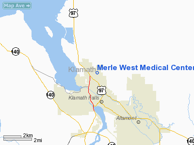
Merle West Medical Center Heliport |
Location & QuickFacts
| FAA Information Effective: | 2008-09-25 |
| Airport Identifier: | 9OR3 |
| Airport Status: | Operational |
| Longitude/Latitude: | 121-47-04.0140W/42-15-14.5190N
-121.784448/42.254033 (Estimated) |
| Elevation: | 4420 ft / 1347.22 m (Estimated) |
| Land: | 0 acres |
| From nearest city: | 2 nautical miles NW of Klamath Falls, OR |
| Location: | Klamath County, OR |
| Magnetic Variation: | 18E (1985) |
Owner & Manager
| Ownership: | Privately owned |
| Owner: | Klamath Falls Hosp. Authority |
| Address: | 2865 Daggett Street
Klamath Falls, OR 97601 |
| Phone number: | 503-882-6311 |
| Manager: | Paul Stewart, Administrator |
| Address: | 2865 Dagget Street
Klamath Falls, OR 97601 |
| Phone number: | 503-882-6311 |
Airport Operations and Facilities
| Airport Use: | Private
MEDICAL USE. |
| Wind indicator: | Yes |
| Segmented Circle: | No |
| Control Tower: | No |
| Landing fee charge: | No |
| Sectional chart: | Klamath Falls |
| Region: | ANM - Northwest Mountain |
| Boundary ARTCC: | ZSE - Seattle |
| Tie-in FSS: | MMV - Mc Minnville |
| FSS on Airport: | No |
| FSS Toll Free: | 1-800-WX-BRIEF |
Runway Information
Helipad H1
| Dimension: | 30 x 30 ft / 9.1 x 9.1 m |
| Surface: | CONC, |
| |
Runway H1 |
Runway |
| Traffic Pattern: | Left | Left |
|
Radio Navigation Aids
| ID |
Type |
Name |
Ch |
Freq |
Var |
Dist |
| LFA | NDB | Merrill | | 347.00 | 17E | 17.4 nm |
| MOG | NDB | Montague | | 404.00 | 19E | 44.4 nm |
| MEF | NDB | Medford | | 356.00 | 19E | 49.3 nm |
| LMT | VORTAC | Klamath Falls | 106X | 115.90 | 17E | 6.6 nm |
| MFR | VOT | Medford-jackson County | | 117.20 | | 48.5 nm |
Remarks
- E111 PRVDD HELI USERS ESTAB 2-WAY RADIO CTC WITH KLAMATH FALLS CTL TWR PRIOR TO ENTERING KLAMATH FALLS CTL ZONE & PRIOR TO DEP FROM HELI.
Images and information placed above are from
http://www.airport-data.com/airport/9OR3/
We thank them for the data!
| General Info
|
| Country |
United States
|
| State |
OREGON
|
| FAA ID |
9OR3
|
| Latitude |
42-15-14.519N
|
| Longitude |
121-47-04.014W
|
| Elevation |
4420 feet
|
| Near City |
KLAMATH FALLS
|
We don't guarantee the information is fresh and accurate. The data may
be wrong or outdated.
For more up-to-date information please refer to other sources.
|
|


