 |
|
Location & QuickFacts
| FAA Information Effective: | 2008-09-25 |
| Airport Identifier: | OG22 |
| Airport Status: | Operational |
| Longitude/Latitude: | 123-21-57.3000W/43-14-33.4000N
-123.365917/43.242611 (Estimated) |
| Elevation: | 495 ft / 150.88 m (Estimated) |
| Land: | 495 acres |
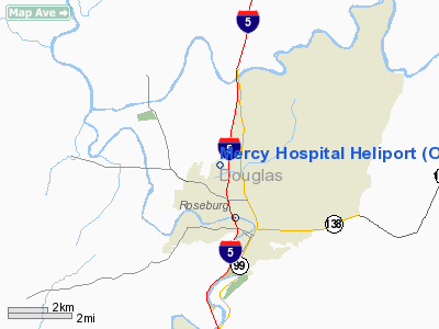
| From nearest city: | 2 nautical miles N of Roseburg, OR |
| Location: | Douglas County, OR |
| Magnetic Variation: | 18E (1995) |
Owner & Manager
| Ownership: | Privately owned |
| Owner: | Mercy Medical Center |
| Address: | 2700 Stewert Parkway
Roseburg, OR 97470 |
| Phone number: | 541-677-2158 |
| Manager: | A J Haber, Director General Service |
| Address: | 2700 Stewart Parkway
Roseburg, OR 97470 |
| Phone number: | 541-677-2158 |
Airport Operations and Facilities
| Airport Use: | Private
MEDICAL USE. |
| Wind indicator: | Yes |
| Segmented Circle: | No |
| Control Tower: | No |
| Lighting Schedule: | RDO-CTL
ACTVT PERIMETER LGTS RY H1 - 155.34. |
| Sectional chart: | Klamath Falls |
| Region: | ANM - Northwest Mountain |
| Boundary ARTCC: | ZSE - Seattle |
| Tie-in FSS: | MMV - Mc Minnville |
| FSS Toll Free: | 1-800-WX-BRIEF |
Runway Information
Helipad H1
| Dimension: | 66 x 66 ft / 20.1 x 20.1 m |
| Surface: | ASPH, |
| |
Runway H1 |
Runway |
| Traffic Pattern: | Left | Left |
|
Radio Navigation Aids
| ID |
Type |
Name |
Ch |
Freq |
Var |
Dist |
| RBG | NDB | Roseburg | | 400.00 | 20E | 0.6 nm |
| RBG | VOR/DME | Roseburg | 019X | 108.20 | 20E | 3.7 nm |
| OTH | VORTAC | North Bend | 058X | 112.10 | 18E | 36.6 nm |
Images and information placed above are from
http://www.airport-data.com/airport/OG22/
We thank them for the data!
| General Info
|
| Country |
United States
|
| State |
OREGON
|
| FAA ID |
OG22
|
| Latitude |
43-14-33.400N
|
| Longitude |
123-21-57.300W
|
| Elevation |
495 feet
|
| Near City |
ROSEBURG
|
We don't guarantee the information is fresh and accurate. The data may
be wrong or outdated.
For more up-to-date information please refer to other sources.
|
|


