 |
|
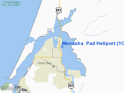
Location & QuickFacts
| FAA Information Effective: | 2008-09-25 |
| Airport Identifier: | 1OR2 |
| Airport Status: | Operational |
| Longitude/Latitude: | 124-13-05.4060W/43-24-31.4040N
-124.218168/43.408723 (Estimated) |
| Elevation: | 14 ft / 4.27 m (Estimated) |
| Land: | 0 acres |
| From nearest city: | 0 nautical miles NE of North Bend, OR |
| Location: | Coos County, OR |
| Magnetic Variation: | 19E (1985) |
Owner & Manager
| Ownership: | Privately owned |
| Owner: | Menasha Corp |
| Address: | Po Box 588
North Bend, OR 97459 |
| Phone number: | 503-756-1193 |
| Address: |
|
Airport Operations and Facilities
| Airport Use: | Private |
| Wind indicator: | No |
| Segmented Circle: | No |
| Control Tower: | No |
| Sectional chart: | Klamath Falls |
| Region: | ANM - Northwest Mountain |
| Boundary ARTCC: | ZSE - Seattle |
| Tie-in FSS: | MMV - Mc Minnville |
| FSS on Airport: | No |
| FSS Toll Free: | 1-800-WX-BRIEF |
Runway Information
Helipad H1
| Dimension: | 80 x 80 ft / 24.4 x 24.4 m |
| Surface: | CONC, |
| |
Runway H1 |
Runway |
| Traffic Pattern: | Left | Left |
|
Radio Navigation Aids
| ID |
Type |
Name |
Ch |
Freq |
Var |
Dist |
| RBG | NDB | Roseburg | | 400.00 | 20E | 39.0 nm |
| RBG | VOR/DME | Roseburg | 019X | 108.20 | 20E | 40.3 nm |
| OTH | VORTAC | North Bend | 058X | 112.10 | 18E | 2.2 nm |
Images and information placed above are from
http://www.airport-data.com/airport/1OR2/
We thank them for the data!
| General Info
|
| Country |
United States
|
| State |
OREGON
|
| FAA ID |
1OR2
|
| Latitude |
43-24-31.404N
|
| Longitude |
124-13-05.406W
|
| Elevation |
14 feet
|
| Near City |
NORTH BEND
|
We don't guarantee the information is fresh and accurate. The data may
be wrong or outdated.
For more up-to-date information please refer to other sources.
|
|


