 |
|
| Memaloose Airport |
| IATA: none – ICAO: none – FAA LID: 25U |
| Summary |
| Airport type |
Public |
| Operator |
US Forest Service |
| Location |
Imnaha, Oregon |
| Elevation AMSL |
6708 ft / 2044 m |
| Coordinates |
45°25′39.5700″N 116°41′37.5280″W / 45.4276583°N 116.69375778°W / 45.4276583; -116.69375778Coordinates: 45°25′39.5700″N 116°41′37.5280″W / 45.4276583°N 116.69375778°W / 45.4276583; -116.69375778 |
| Website |
http://www.fs.fed.us/r6/w-w/fire/airstrips.htm#mem |
| Runways |
| Direction |
Length |
Surface |
| ft |
m |
| 17/35 |
3300 |
1006 |
dirt |
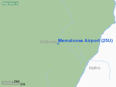
Memaloose Airport (FAA LID: 25U), is a public airport located 10 miles (16 km) southeast of Imnaha in Wallowa County, Oregon, USA.
The above content comes from Wikipedia and is published under free licenses – click here to read more.
Location & QuickFacts
| FAA Information Effective: | 2008-09-25 |
| Airport Identifier: | 25U |
| Airport Status: | Operational |
| Longitude/Latitude: | 116-41-37.5280W/45-25-39.5700N
-116.693758/45.427658 (Estimated) |
| Elevation: | 6708 ft / 2044.60 m (Surveyed) |
| Land: | 40 acres |
| From nearest city: | 10 nautical miles SE of Imnaha, OR |
| Location: | Wallowa County, OR |
| Magnetic Variation: | 18E (1985) |
Owner & Manager
| Ownership: | Publicly owned |
| Owner: | Usfs Wallowa-whitman |
| Address: | Po Box 907
Baker City, OR 97814 |
| Phone number: | 541-523-6391 |
| Manager: | Miles Hancock Fs Avn Officer |
| Address: | 60131 Pierce Rd.
La Grande, OR 97850 |
| Phone number: | 541-962-8648 |
Airport Operations and Facilities
| Airport Use: | Open to public |
| Wind indicator: | Yes |
| Segmented Circle: | No |
| Control Tower: | No |
| Landing fee charge: | No |
| Sectional chart: | Great Falls |
| Region: | ANM - Northwest Mountain |
| Boundary ARTCC: | ZSE - Seattle |
| Tie-in FSS: | MMV - Mc Minnville |
| FSS on Airport: | No |
| FSS Toll Free: | 1-800-WX-BRIEF |
| NOTAMs Facility: | MMV (NOTAM-d service avaliable) |
Airport Communications
Airport Services
| Airframe Repair: | NONE |
| Power Plant Repair: | NONE |
| Bottled Oxygen: | NONE |
| Bulk Oxygen: | NONE |
Runway Information
Runway 17/35
| Dimension: | 3300 x 120 ft / 1005.8 x 36.6 m |
| Surface: | DIRT, Poor Condition
LOOSE 3 IN - 6 IN ROCKS ON RY; RY POORLY DEFINED. SOUTH 1000 FT ROUGH & OVERGROWN WITH WEEDS. |
| |
Runway 17 |
Runway 35 |
| Traffic Pattern: | Right | Right |
| Obstruction: | 65 ft trees, 1800.0 ft from runway, 27:1 slope to clear | , 50:1 slope to clear |
|
Radio Navigation Aids
| ID |
Type |
Name |
Ch |
Freq |
Var |
Dist |
| GVV | NDB | Grain | | 280.00 | 18E | 36.6 nm |
| IOM | NDB | Mc Call | | 363.00 | 17E | 45.0 nm |
| DNJ | VORTAC | Donnelly | 109X | 116.20 | 19E | 44.8 nm |
Remarks
- CLSD WINTERS
- EARLY SPRING: DAMP SOFT SPOT ON NORTH END OF RWY; LAND LONG TO SOUTH.
- RY 35 EXPECT DOWNDRAFTS ON SHORT FINAL DUE TO SHEER DROP IN TERRAIN.
- LIVESTOCK AND WILDLIFE ON & INVOF ARPT.
- RY 17 SLOPES UP 2.5 % TO SOUTH.
- NO LINE OF SIGHT BTN RY ENDS.
- RY 35 HAS 9 INCH BERM ALONG L SHOULDER 500 FT.
- ESTABD PRIOR TO 1959.
Images and information placed above are from
http://www.airport-data.com/airport/25U/
We thank them for the data!
| General Info
|
| Country |
United States
|
| State |
OREGON
|
| FAA ID |
25U
|
| Latitude |
45-25-39.570N
|
| Longitude |
116-41-37.528W
|
| Elevation |
6708 feet
|
| Near City |
IMNAHA
|
We don't guarantee the information is fresh and accurate. The data may
be wrong or outdated.
For more up-to-date information please refer to other sources.
|
|


