 |
|
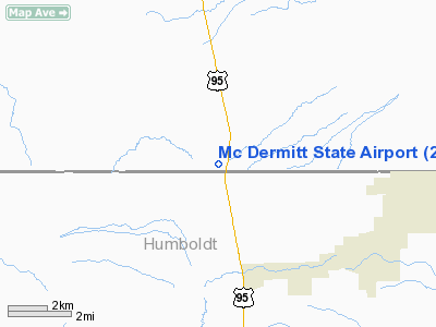
| McDermitt State Airport |
| IATA: none – ICAO: none – FAA LID: 26U |
| Summary |
| Airport type |
Public |
| Operator |
Oregon Department of Aviation |
| Location |
McDermitt, Oregon |
| Elevation AMSL |
4478 ft / 1365 m |
| Coordinates |
42°00′07.5990″N 117°43′23.5100″W / 42.00211083°N 117.7231972°W / 42.00211083; -117.7231972Coordinates: 42°00′07.5990″N 117°43′23.5100″W / 42.00211083°N 117.7231972°W / 42.00211083; -117.7231972 |
| Runways |
| Direction |
Length |
Surface |
| ft |
m |
| 16/34 |
5900 |
1798 |
Asphalt |
McDermitt State Airport (FAA LID: 26U), is a public airport located ½ mile (0.75 km) northwest of McDermitt, Nevada in Malheur County, Oregon, USA.
The above content comes from Wikipedia and is published under free licenses – click here to read more.
Location & QuickFacts
| FAA Information Effective: | 2008-09-25 |
| Airport Identifier: | 26U |
| Airport Status: | Operational |
| Longitude/Latitude: | 117-43-23.5100W/42-00-07.5990N
-117.723197/42.002111 (Estimated) |
| Elevation: | 4478 ft / 1364.89 m (Estimated) |
| Land: | 139 acres |
| From nearest city: | 0 nautical miles W of Mc Dermitt, OR |
| Location: | Malheur County, OR |
| Magnetic Variation: | 17E (1985) |
Owner & Manager
| Ownership: | Publicly owned |
| Owner: | Oregon Department Of Aviation |
| Address: | 3040 25th St Se
Salem, OR 97302-1125 |
| Phone number: | 503-378-4880 |
| Manager: | State Airports Manager |
| Address: | 3040 25th St Se
Salem, OR 97302-1125 |
| Phone number: | 503-378-4880 |
Airport Operations and Facilities
| Airport Use: | Open to public |
| Wind indicator: | Yes |
| Segmented Circle: | Yes |
| Control Tower: | No |
| Lighting Schedule: | DUSK-DAWN |
| Beacon Color: | Clear-Green (lighted land airport) |
| Landing fee charge: | No |
| Sectional chart: | Klamath Falls |
| Region: | ANM - Northwest Mountain |
| Traffic Pattern Alt: | 1000 ft |
| Boundary ARTCC: | ZLC - Salt Lake City |
| Tie-in FSS: | MMV - Mc Minnville |
| FSS on Airport: | No |
| FSS Toll Free: | 1-800-WX-BRIEF |
| NOTAMs Facility: | MMV (NOTAM-d service avaliable) |
| Federal Agreements: | NGY |
Airport Communications
Airport Services
| Airframe Repair: | NONE |
| Power Plant Repair: | NONE |
Runway Information
Runway 16/34
| Dimension: | 5900 x 60 ft / 1798.3 x 18.3 m |
| Surface: | ASPH, Good Condition |
| Weight Limit: | Single wheel: 12500 lbs. |
| Edge Lights: | Low |
| |
Runway 16 |
Runway 34 |
| Traffic Pattern: | Left | Left |
| Markings: | Basic, Good Condition | Basic, Good Condition |
|
Radio Navigation Aids
| ID |
Type |
Name |
Ch |
Freq |
Var |
Dist |
| RMD | NDB | Mc Dermitt State | | 204.00 | 17E | 0.6 nm |
| REO | VORTAC | Rome | 072X | 112.50 | 19E | 36.0 nm |
| SDO | VORTAC | Sod House | 090X | 114.30 | 18E | 38.4 nm |
Remarks
- VEGETATION GROWING IN PRIMARY SURFACE.
- RISING TERRAIN TO NORTH OF ARPT AT APPROXIMATELY 2% FOR 10000 FT.
Images and information placed above are from
http://www.airport-data.com/airport/26U/
We thank them for the data!
| General Info
|
| Country |
United States
|
| State |
OREGON
|
| FAA ID |
26U
|
| Latitude |
42-00-07.599N
|
| Longitude |
117-43-23.510W
|
| Elevation |
4478 feet
|
| Near City |
MC DERMITT
|
We don't guarantee the information is fresh and accurate. The data may
be wrong or outdated.
For more up-to-date information please refer to other sources.
|
|


