 |
|
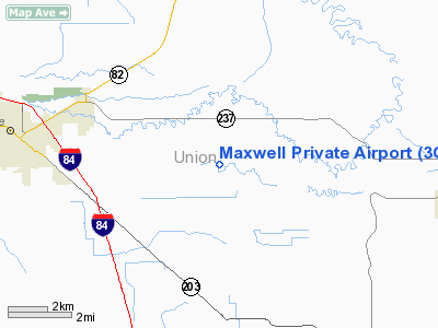
Location & QuickFacts
| FAA Information Effective: | 2008-09-25 |
| Airport Identifier: | 3OR2 |
| Airport Status: | Operational |
| Longitude/Latitude: | 117-57-30.7710W/45-18-44.4860N
-117.958548/45.312357 (Estimated) |
| Elevation: | 2710 ft / 826.01 m (Estimated) |
| Land: | 0 acres |
| From nearest city: | 5 nautical miles W of La Grande, OR |
| Location: | Union County, OR |
| Magnetic Variation: | 18E (1985) |
Owner & Manager
| Ownership: | Privately owned |
| Owner: | James Maxwell |
| Address: | 61107 Peach Rd
La Grande, OR 97850 |
| Phone number: | 503-963-6899 |
| Manager: | James Maxwell |
| Address: | 61107 Peach Rd
La Grande, OR 97850 |
| Phone number: | 503-963-6899 |
Airport Operations and Facilities
| Airport Use: | Private |
| Wind indicator: | Yes |
| Segmented Circle: | No |
| Control Tower: | No |
| Sectional chart: | Seattle |
| Region: | ANM - Northwest Mountain |
| Boundary ARTCC: | ZSE - Seattle |
| Tie-in FSS: | MMV - Mc Minnville |
| FSS on Airport: | No |
| FSS Toll Free: | 1-800-WX-BRIEF |
Runway Information
Runway 13/31
| Dimension: | 2200 x 50 ft / 670.6 x 15.2 m |
| Surface: | GRVL, |
| |
Runway 13 |
Runway 31 |
| Traffic Pattern: | Left | Left |
|
Radio Navigation Aids
| ID |
Type |
Name |
Ch |
Freq |
Var |
Dist |
| LGD | NDB | La Grande | | 296.00 | 17E | 1.8 nm |
| PD | NDB | Foris | | 230.00 | 20E | 39.9 nm |
| BKE | VOR/DME | Baker City | 100X | 115.30 | 20E | 29.1 nm |
| ALW | VOR/DME | Walla Walla | 111X | 116.40 | 20E | 48.6 nm |
| PDT | VORTAC | Pendleton | 094X | 114.70 | 20E | 47.4 nm |
Images and information placed above are from
http://www.airport-data.com/airport/3OR2/
We thank them for the data!
| General Info
|
| Country |
United States
|
| State |
OREGON
|
| FAA ID |
3OR2
|
| Latitude |
45-18-44.486N
|
| Longitude |
117-57-30.771W
|
| Elevation |
2710 feet
|
| Near City |
LA GRANDE
|
We don't guarantee the information is fresh and accurate. The data may
be wrong or outdated.
For more up-to-date information please refer to other sources.
|
|


