 |
|
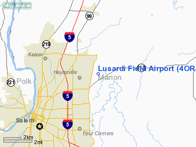
Location & QuickFacts
| FAA Information Effective: | 2008-09-25 |
| Airport Identifier: | 4OR7 |
| Airport Status: | Operational |
| Longitude/Latitude: | 122-56-46.3400W/44-59-07.4320N
-122.946206/44.985398 (Estimated) |
| Elevation: | 205 ft / 62.48 m (Estimated) |
| Land: | 24 acres |
| From nearest city: | 7 nautical miles NE of Salem, OR |
| Location: | Marion County, OR |
| Magnetic Variation: | 19E (1985) |
Owner & Manager
| Ownership: | Privately owned |
| Owner: | Robert Lusardi |
| Address: | 5605 Ibex St Ne
Salem, OR 97305 |
| Phone number: | 503-399-7123 |
| Manager: | Robert Lusardi |
| Address: | 5605 Ibex St Ne
Salem, OR 97305 |
| Phone number: | 503-319-2370 |
Airport Operations and Facilities
| Airport Use: | Private |
| Wind indicator: | Yes |
| Segmented Circle: | No |
| Control Tower: | No |
| Lighting Schedule: | PHONE REQ
FOR RY LIGHTS CALL 503-931-0404. |
| Sectional chart: | Seattle |
| Region: | ANM - Northwest Mountain |
| Boundary ARTCC: | ZSE - Seattle |
| Tie-in FSS: | MMV - Mc Minnville |
| FSS on Airport: | No |
| FSS Toll Free: | 1-800-WX-BRIEF |
Airport Services
Runway Information
Runway 17/35
| Dimension: | 2200 x 60 ft / 670.6 x 18.3 m |
| Surface: | TURF, |
| Edge Lights: | Low |
| |
Runway 17 |
Runway 35 |
| Traffic Pattern: | Left | Left |
|
Radio Navigation Aids
| ID |
Type |
Name |
Ch |
Freq |
Var |
Dist |
| LWG | NDB | Lewisburg | | 225.00 | 18E | 26.3 nm |
| PND | NDB | Banks | | 356.00 | 21E | 39.0 nm |
| LBH | NDB | Laker | | 332.00 | 20E | 39.2 nm |
| EU | NDB | Frakk | | 260.00 | 19E | 47.9 nm |
| CBU | TACAN | Columbia | 029X | | 20E | 38.9 nm |
| UBG | VOR/DME | Newberg | 121X | 117.40 | 21E | 22.2 nm |
| CVO | VOR/DME | Corvallis | 101X | 115.40 | 18E | 32.8 nm |
| PDX | VOR/DME | Portland | 055X | 111.80 | 20E | 39.3 nm |
| BTG | VORTAC | Battle Ground | 113X | 116.60 | 21E | 48.2 nm |
| HIO | VOT | Portland-hillsboro | | 115.20 | | 33.4 nm |
| PDX | VOT | Portland Intl | | 111.00 | | 39.6 nm |
Remarks
- RY 35 PREFERRED CALM WIND RY.
Images and information placed above are from
http://www.airport-data.com/airport/4OR7/
We thank them for the data!
| General Info
|
| Country |
United States
|
| State |
OREGON
|
| FAA ID |
4OR7
|
| Latitude |
44-59-07.432N
|
| Longitude |
122-56-46.340W
|
| Elevation |
205 feet
|
| Near City |
SALEM
|
We don't guarantee the information is fresh and accurate. The data may
be wrong or outdated.
For more up-to-date information please refer to other sources.
|
|


