 |
|
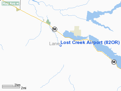
Location & QuickFacts
| FAA Information Effective: | 2008-09-25 |
| Airport Identifier: | 82OR |
| Airport Status: | Operational |
| Longitude/Latitude: | 122-49-01.2570W/43-53-57.4510N
-122.817016/43.899292 (Estimated) |
| Elevation: | 700 ft / 213.36 m (Estimated) |
| Land: | 0 acres |
| From nearest city: | 1 nautical miles S of Dexter, OR |
| Location: | Lane County, OR |
| Magnetic Variation: | 19E (1985) |
Owner & Manager
| Ownership: | Privately owned |
| Owner: | Paul Bruington |
| Address: | 82166 Mt.zion Drive
Dexter, OR 97431 |
| Phone number: | 503-937-2459 |
| Address: |
|
Airport Operations and Facilities
| Airport Use: | Private |
| Segmented Circle: | No |
| Control Tower: | No |
| Sectional chart: | Seattle |
| Region: | ANM - Northwest Mountain |
| Boundary ARTCC: | ZSE - Seattle |
| Tie-in FSS: | MMV - Mc Minnville |
| FSS Toll Free: | 1-800-WX-BRIEF |
Runway Information
Runway 16/34
| Dimension: | 2265 x 30 ft / 690.4 x 9.1 m |
| Surface: | TURF, |
| |
Runway 16 |
Runway 34 |
| Traffic Pattern: | Left | Left |
| Obstruction: | | 20 ft pline, 150.0 ft from runway |
|
Radio Navigation Aids
| ID |
Type |
Name |
Ch |
Freq |
Var |
Dist |
| EU | NDB | Frakk | | 260.00 | 19E | 25.7 nm |
| RBG | NDB | Roseburg | | 400.00 | 20E | 46.3 nm |
| LWG | NDB | Lewisburg | | 225.00 | 18E | 47.2 nm |
| CVO | VOR/DME | Corvallis | 101X | 115.40 | 18E | 41.5 nm |
| RBG | VOR/DME | Roseburg | 019X | 108.20 | 20E | 49.0 nm |
| EUG | VORTAC | Eugene | 076X | 112.90 | 20E | 22.0 nm |
Remarks
- FILED FOR RECORD PURPOSES ONLY.
Images and information placed above are from
http://www.airport-data.com/airport/82OR/
We thank them for the data!
| General Info
|
| Country |
United States
|
| State |
OREGON
|
| FAA ID |
82OR
|
| Latitude |
43-53-57.451N
|
| Longitude |
122-49-01.257W
|
| Elevation |
700 feet
|
| Near City |
DEXTER
|
We don't guarantee the information is fresh and accurate. The data may
be wrong or outdated.
For more up-to-date information please refer to other sources.
|
|


