 |
|
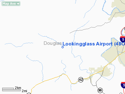
Location & QuickFacts
| FAA Information Effective: | 2008-09-25 |
| Airport Identifier: | 48OR |
| Airport Status: | Operational |
| Longitude/Latitude: | 123-30-06.2790W/43-09-33.4140N
-123.501744/43.159282 (Estimated) |
| Elevation: | 580 ft / 176.78 m (Estimated) |
| Land: | 8 acres |
| From nearest city: | 7 nautical miles SW of Roseburg, OR |
| Location: | Douglas County, OR |
| Magnetic Variation: | 18E (1995) |
Owner & Manager
| Ownership: | Privately owned |
| Owner: | Donald D Hunt |
| Address: | 250 Strickland Canyon Road
Roseburg, OR 97470 |
| Phone number: | 503-459-9279 |
| Manager: | Donald D Hunt |
| Address: | 250 Strickland Canyon Road
Roseburg, OR 97470 |
| Phone number: | 503-679-3721 |
Airport Operations and Facilities
| Airport Use: | Private |
| Wind indicator: | Yes |
| Segmented Circle: | No |
| Control Tower: | No |
| Sectional chart: | Klamath Falls |
| Region: | ANM - Northwest Mountain |
| Boundary ARTCC: | ZSE - Seattle |
| Tie-in FSS: | MMV - Mc Minnville |
| FSS Toll Free: | 1-800-WX-BRIEF |
Runway Information
Runway 07/25
| Dimension: | 2600 x 20 ft / 792.5 x 6.1 m |
| Surface: | ASPH, |
| |
Runway 07 |
Runway 25 |
| Traffic Pattern: | Left | Left |
| Obstruction: | 400 ft hill, 2000.0 ft from runway | |
|
Radio Navigation Aids
| ID |
Type |
Name |
Ch |
Freq |
Var |
Dist |
| RBG | NDB | Roseburg | | 400.00 | 20E | 7.8 nm |
| RBG | VOR/DME | Roseburg | 019X | 108.20 | 20E | 6.7 nm |
| OTH | VORTAC | North Bend | 058X | 112.10 | 18E | 33.0 nm |
| OED | VORTAC | Rogue Valley | 083X | 113.60 | 19E | 48.4 nm |
Images and information placed above are from
http://www.airport-data.com/airport/48OR/
We thank them for the data!
| General Info
|
| Country |
United States
|
| State |
OREGON
|
| FAA ID |
48OR
|
| Latitude |
43-09-33.414N
|
| Longitude |
123-30-06.279W
|
| Elevation |
580 feet
|
| Near City |
ROSEBURG
|
We don't guarantee the information is fresh and accurate. The data may
be wrong or outdated.
For more up-to-date information please refer to other sources.
|
|


