 |
|
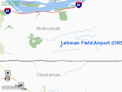
Location & QuickFacts
| FAA Information Effective: | 2008-09-25 |
| Airport Identifier: | OR50 |
| Airport Status: | Operational |
| Longitude/Latitude: | 122-14-02.3220W/45-29-08.4330N
-122.233978/45.485676 (Estimated) |
| Elevation: | 1003 ft / 305.71 m (Surveyed) |
| Land: | 0 acres |
| From nearest city: | 3 nautical miles SE of Corbett, OR |
| Location: | Multnomah County, OR |
| Magnetic Variation: | 19E (1985) |
Owner & Manager
| Ownership: | Privately owned |
| Owner: | J Thomas Lehman |
| Address: | 41313 Se Troutcreek Road
Corbett, OR 97019 |
| Phone number: | 503-695-2836 |
| Manager: | J. Thomas Lehman |
| Address: | 41313 Se Troutcreek Rd
Corbett, OR 97019 |
| Phone number: | 503-695-2836 |
Airport Operations and Facilities
| Airport Use: | Private |
| Wind indicator: | No |
| Segmented Circle: | No |
| Control Tower: | No |
| Landing fee charge: | No |
| Sectional chart: | Seattle |
| Region: | ANM - Northwest Mountain |
| Boundary ARTCC: | ZSE - Seattle |
| Tie-in FSS: | MMV - Mc Minnville |
| FSS on Airport: | No |
| FSS Toll Free: | 1-800-WX-BRIEF |
Airport Services
| Airframe Repair: | NONE |
| Power Plant Repair: | NONE |
Runway Information
Runway E/W
| Dimension: | 2300 x 25 ft / 701.0 x 7.6 m |
| Surface: | TURF, |
| |
Runway E |
Runway W |
| Traffic Pattern: | Left | Left |
| Obstruction: | | 50 ft trees, 100.0 ft from runway |
|
Radio Navigation Aids
| ID |
Type |
Name |
Ch |
Freq |
Var |
Dist |
| LBH | NDB | Laker | | 332.00 | 20E | 10.2 nm |
| PND | NDB | Banks | | 356.00 | 21E | 35.3 nm |
| LSO | NDB | Kelso | | 256.00 | 21E | 49.3 nm |
| CBU | TACAN | Columbia | 029X | | 20E | 17.0 nm |
| PDX | VOR/DME | Portland | 055X | 111.80 | 20E | 17.0 nm |
| UBG | VOR/DME | Newberg | 121X | 117.40 | 21E | 32.4 nm |
| LTJ | VOR/DME | Klickitat | 070X | 112.30 | 21E | 49.6 nm |
| BTG | VORTAC | Battle Ground | 113X | 116.60 | 21E | 21.8 nm |
| PDX | VOT | Portland Intl | | 111.00 | | 16.9 nm |
| HIO | VOT | Portland-hillsboro | | 115.20 | | 30.3 nm |
Images and information placed above are from
http://www.airport-data.com/airport/OR50/
We thank them for the data!
| General Info
|
| Country |
United States
|
| State |
OREGON
|
| FAA ID |
OR50
|
| Latitude |
45-29-08.433N
|
| Longitude |
122-14-02.322W
|
| Elevation |
1003 feet
|
| Near City |
CORBETT
|
We don't guarantee the information is fresh and accurate. The data may
be wrong or outdated.
For more up-to-date information please refer to other sources.
|
|


