 |
|
Location & QuickFacts
| FAA Information Effective: | 2008-09-25 |
| Airport Identifier: | OG18 |
| Airport Status: | Operational |
| Longitude/Latitude: | 118-49-50.7000W/43-28-46.5000N
-118.830750/43.479583 (Estimated) |
| Elevation: | 4130 ft / 1258.82 m (Estimated) |
| Land: | 80 acres |
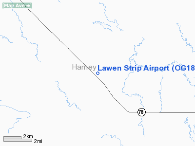
| From nearest city: | 2 nautical miles NW of Lawen, OR |
| Location: | Harney County, OR |
| Magnetic Variation: | 17E (1995) |
Owner & Manager
| Ownership: | Privately owned |
| Owner: | E David & Donna J Evans |
| Address: | Po Box 831
Burns, OR 97720 |
| Phone number: | 541-573-7019 |
| Manager: | E David Evans |
| Address: | Po Box 831
Burns, OR 97720 |
| Phone number: | 541-578-7019 |
Airport Operations and Facilities
| Airport Use: | Private |
| Segmented Circle: | No |
| Control Tower: | No |
| Sectional chart: | Klamath Falls |
| Region: | ANM - Northwest Mountain |
| Boundary ARTCC: | ZSE - Seattle |
| Tie-in FSS: | MMV - Mc Minnville |
| FSS Toll Free: | 1-800-WX-BRIEF |
Runway Information
Runway 03/21
| Dimension: | 1850 x 100 ft / 563.9 x 30.5 m |
| Surface: | TURF-DIRT, |
| |
Runway 03 |
Runway 21 |
| Traffic Pattern: | Left | Left |
| Obstruction: | 20 ft pline | 4 ft fence, 0.0 ft from runway |
|
Runway 15/33
| Dimension: | 2660 x 100 ft / 810.8 x 30.5 m |
| Surface: | TURF-DIRT, |
| |
Runway 15 |
Runway 33 |
| Traffic Pattern: | Left | Left |
| Obstruction: | 4 ft fence | 4 ft fence, 0.0 ft from runway |
|
Radio Navigation Aids
| ID |
Type |
Name |
Ch |
Freq |
Var |
Dist |
| ILR | VOR/DME | Wildhorse | 085X | 113.80 | 18E | 8.7 nm |
Images and information placed above are from
http://www.airport-data.com/airport/OG18/
We thank them for the data!
| General Info
|
| Country |
United States
|
| State |
OREGON
|
| FAA ID |
OG18
|
| Latitude |
43-28-46.500N
|
| Longitude |
118-49-50.700W
|
| Elevation |
4130 feet
|
| Near City |
LAWEN
|
We don't guarantee the information is fresh and accurate. The data may
be wrong or outdated.
For more up-to-date information please refer to other sources.
|
|


