 |
|
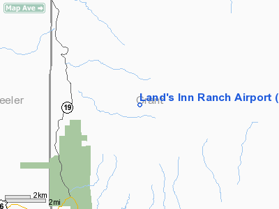
Location & QuickFacts
| FAA Information Effective: | 2008-09-25 |
| Airport Identifier: | 49OR |
| Airport Status: | Operational |
| Longitude/Latitude: | 119-33-50.9440W/44-35-37.5200N
-119.564151/44.593756 (Estimated) |
| Elevation: | 3880 ft / 1182.62 m (Estimated) |
| Land: | 320 acres |
| From nearest city: | 8 nautical miles N of Dayville, OR |
| Location: | Grant County, OR |
| Magnetic Variation: | 18E (1985) |
Owner & Manager
| Ownership: | Privately owned |
| Owner: | Thomas M. Buce |
| Address: | H.c. 82 Box 117
Kimberly, OR 97848 |
| Phone number: | 503-934-2333 |
| Manager: | Thomas M. Buce |
| Address: | H.c. 82 Box 117
Kimberly, OR 97848 |
| Phone number: | 503-934-2333 |
Airport Operations and Facilities
| Airport Use: | Private |
| Wind indicator: | Yes |
| Segmented Circle: | Yes |
| Control Tower: | No |
| Landing fee charge: | No |
| Sectional chart: | Seattle |
| Region: | ANM - Northwest Mountain |
| Boundary ARTCC: | ZSE - Seattle |
| Tie-in FSS: | MMV - Mc Minnville |
| FSS on Airport: | No |
| FSS Toll Free: | 1-800-WX-BRIEF |
Airport Communications
Runway Information
Runway 13/31
| Dimension: | 2600 x 30 ft / 792.5 x 9.1 m |
| Surface: | TURF, Fair Condition |
| |
Runway 13 |
Runway 31 |
| Traffic Pattern: | Right | Left |
|
Radio Navigation Aids
| ID |
Type |
Name |
Ch |
Freq |
Var |
Dist |
| IMB | VORTAC | Kimberly | 103X | 115.60 | 20E | 7.1 nm |
Remarks
- NO WINTER MAINTENANCE.
- FILED FOR RECORD PURPOSES ONLY.
Images and information placed above are from
http://www.airport-data.com/airport/49OR/
We thank them for the data!
| General Info
|
| Country |
United States
|
| State |
OREGON
|
| FAA ID |
49OR
|
| Latitude |
44-35-37.520N
|
| Longitude |
119-33-50.944W
|
| Elevation |
3880 feet
|
| Near City |
DAYVILLE
|
We don't guarantee the information is fresh and accurate. The data may
be wrong or outdated.
For more up-to-date information please refer to other sources.
|
|


