 |
|
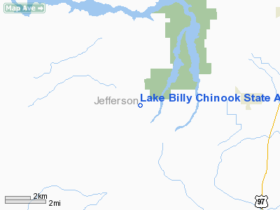
Lake Billy Chinook State Airport |
| Lake Billy Chinook Airport |
| IATA: none – ICAO: none – FAA LID: 5S5 |
| Summary |
| Airport type |
Public |
| Owner |
Lake Billy Chinook Airport Develop. Corp. |
| Location |
Culver, Oregon |
| Elevation AMSL |
2,695 ft / 821 m |
| Coordinates |
44°31′09″N 121°19′14″W / 44.51917°N 121.32056°W / 44.51917; -121.32056 |
| Runways |
| Direction |
Length |
Surface |
| ft |
m |
| 16/34 |
2,500 |
762 |
Asphalt |
| Statistics (2004) |
| Aircraft operations |
560 |
| Source: Federal Aviation Administration |
Lake Billy Chinook Airport (FAA LID: 5S5), formerly known as Lake Billy Chinook State Airport, is a public airport located six miles (10 km) west of the central business district of Culver, in Jefferson County, Oregon, United States. This airport is privately owned by Lake Billy Chinook Airport Develop Corp.
Facilities
Lake Billy Chinook Airport covers an area of 29 acres (12 ha) which contains one runway:
- Runway 16/34: 2,500 x 32 ft (762 x 10 m), Surface: Asphalt
For 12-month period ending 31 August 2004 the airport had 560 aircraft operations:
- 100% general aviation: 560
The above content comes from Wikipedia and is published under free licenses – click here to read more.
Location & QuickFacts
| FAA Information Effective: | 2008-09-25 |
| Airport Identifier: | 5S5 |
| Airport Status: | Operational |
| Longitude/Latitude: | 121-19-14.1610W/44-31-09.4250N
-121.320600/44.519285 (Estimated) |
| Elevation: | 2695 ft / 821.44 m (Estimated) |
| Land: | 29 acres |
| From nearest city: | 6 nautical miles W of Culver, OR |
| Location: | Jefferson County, OR |
| Magnetic Variation: | 19E (1985) |
Owner & Manager
| Ownership: | Privately owned |
| Owner: | Lake Billy Chinook Apt Develop Corp |
| Address: | 8031 Sw Airpark Drive
Culver, OR 97734 |
| Phone number: | 503-622-6420 |
| Manager: | Dick Leibelt |
| Address: | 8031 Sw Airpark Drive
Culver, OR 97734 |
| Phone number: | 503-701-7760 |
Airport Operations and Facilities
| Airport Use: | Open to public |
| Wind indicator: | Yes |
| Segmented Circle: | No |
| Control Tower: | No |
| Landing fee charge: | No |
| Sectional chart: | Seattle |
| Region: | ANM - Northwest Mountain |
| Traffic Pattern Alt: | 1000 ft |
| Boundary ARTCC: | ZSE - Seattle |
| Tie-in FSS: | MMV - Mc Minnville |
| FSS on Airport: | No |
| FSS Toll Free: | 1-800-WX-BRIEF |
| NOTAMs Facility: | MMV (NOTAM-d service avaliable) |
Airport Communications
Airport Services
| Airframe Repair: | NONE |
| Power Plant Repair: | NONE |
| Bottled Oxygen: | NONE |
| Bulk Oxygen: | NONE |
Runway Information
Runway 16/34
| Dimension: | 2500 x 32 ft / 762.0 x 9.8 m |
| Surface: | ASPH, Good Condition |
| |
Runway 16 |
Runway 34 |
| Traffic Pattern: | Left | Left |
| Markings: | Nonstandard,
RY 16 NSTD DSPLCD THLD MKGS; DSPLCD THLDS MARKED WITH THREE ORANGE REFLECTIVE MARKER CANS EACH SIDE. | , |
| Displaced threshold: | 660.00 ft | 0.00 ft |
| Obstruction: | 20 ft trees, 450.0 ft from runway, 50 ft right of centerline, 12:1 slope to clear
RWY 16 APCH RATIO 45:1 TO DSPLCD THLD.
+3 ROCK BERM @ 35'. +3 ROAD @ 65'. | 35 ft tree, 612.0 ft from runway, 100 ft left of centerline, 11:1 slope to clear |
|
Radio Navigation Aids
| ID |
Type |
Name |
Ch |
Freq |
Var |
Dist |
| RD | NDB | Bodey | | 411.00 | 18E | 18.1 nm |
| DSD | VORTAC | Deschutes | 123X | 117.60 | 18E | 16.0 nm |
Remarks
- ANIMALS ON & INVOF ARPT.
- RY 16/34 RESTRICTED RY SIGHT DISTANCE.
- GRASS AREA S. OF RY NOT FOR ACFT OPNS.
Images and information placed above are from
http://www.airport-data.com/airport/5S5/
We thank them for the data!
| General Info
|
| Country |
United States
|
| State |
OREGON
|
| FAA ID |
5S5
|
| Latitude |
44-31-09.425N
|
| Longitude |
121-19-14.161W
|
| Elevation |
2695 feet
|
| Near City |
CULVER
|
We don't guarantee the information is fresh and accurate. The data may
be wrong or outdated.
For more up-to-date information please refer to other sources.
|
|


