 |
|
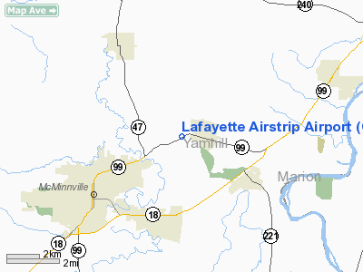
Lafayette Airstrip Airport |
Location & QuickFacts
| FAA Information Effective: | 2008-09-25 |
| Airport Identifier: | OR90 |
| Airport Status: | Operational |
| Longitude/Latitude: | 123-07-44.3750W/45-14-39.4190N
-123.128993/45.244283 (Estimated) |
| Elevation: | 160 ft / 48.77 m (Estimated) |
| Land: | 0 acres |
| From nearest city: | 1 nautical miles W of Lafayette, OR |
| Location: | Yamhill County, OR |
| Magnetic Variation: | 19E (1985) |
Owner & Manager
| Ownership: | Privately owned |
| Owner: | Helen Weeks |
| Address: | 11200 N Hwy 99 W
Mc Minnville, OR 97128 |
| Phone number: | 503-864-2456 |
| Address: |
|
Airport Operations and Facilities
| Airport Use: | Private |
| Wind indicator: | No |
| Segmented Circle: | No |
| Control Tower: | No |
| Landing fee charge: | No |
| Sectional chart: | Seattle |
| Region: | ANM - Northwest Mountain |
| Boundary ARTCC: | ZSE - Seattle |
| Tie-in FSS: | MMV - Mc Minnville |
| FSS on Airport: | No |
| FSS Toll Free: | 1-800-WX-BRIEF |
Airport Services
| Airframe Repair: | NONE |
| Power Plant Repair: | NONE |
Runway Information
Runway 03/21
| Dimension: | 2700 x 70 ft / 823.0 x 21.3 m |
| Surface: | TURF-GRVL, |
| |
Runway 03 |
Runway 21 |
| Traffic Pattern: | Left | Right |
|
Radio Navigation Aids
| ID |
Type |
Name |
Ch |
Freq |
Var |
Dist |
| PND | NDB | Banks | | 356.00 | 21E | 23.5 nm |
| LBH | NDB | Laker | | 332.00 | 20E | 33.3 nm |
| LWG | NDB | Lewisburg | | 225.00 | 18E | 38.4 nm |
| CBU | TACAN | Columbia | 029X | | 20E | 30.1 nm |
| UBG | VOR/DME | Newberg | 121X | 117.40 | 21E | 9.1 nm |
| PDX | VOR/DME | Portland | 055X | 111.80 | 20E | 30.5 nm |
| CVO | VOR/DME | Corvallis | 101X | 115.40 | 18E | 45.3 nm |
| BTG | VORTAC | Battle Ground | 113X | 116.60 | 21E | 37.8 nm |
| HIO | VOT | Portland-hillsboro | | 115.20 | | 19.4 nm |
| PDX | VOT | Portland Intl | | 111.00 | | 30.8 nm |
Remarks
- RESTRICTED TO PESONAL USE OF PROPONENT. VFR DALGT OPNS ONLY.
Images and information placed above are from
http://www.airport-data.com/airport/OR90/
We thank them for the data!
| General Info
|
| Country |
United States
|
| State |
OREGON
|
| FAA ID |
OR90
|
| Latitude |
45-14-39.419N
|
| Longitude |
123-07-44.375W
|
| Elevation |
160 feet
|
| Near City |
LAFAYETTE
|
We don't guarantee the information is fresh and accurate. The data may
be wrong or outdated.
For more up-to-date information please refer to other sources.
|
|


