 |
|
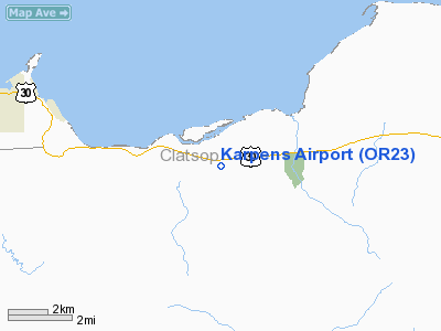
Location & QuickFacts
| FAA Information Effective: | 2008-09-25 |
| Airport Identifier: | OR23 |
| Airport Status: | Operational |
| Longitude/Latitude: | 123-38-25.0000W/46-09-41.0000N
-123.640278/46.161389 (Estimated) |
| Elevation: | 125 ft / 38.10 m (Estimated) |
| Land: | 0 acres |
| From nearest city: | 9 nautical miles E of Astoria, OR |
| Location: | Clatsop County, OR |
| Magnetic Variation: | 20E (1985) |
Owner & Manager
| Ownership: | Privately owned |
| Owner: | Svenson Pilots Assn. |
| Address: | Rt 6 1053 H
Astoria, OR 97103 |
| Phone number: | 503-458-6800 |
| Manager: | Al Simonsen |
| Address: | Rt 6 1053 H
Astoria, OR 97103 |
| Phone number: | 503-458-6800 |
Airport Operations and Facilities
| Airport Use: | Private |
| Wind indicator: | Yes |
| Segmented Circle: | No |
| Control Tower: | No |
| Landing fee charge: | No |
| Sectional chart: | Seattle |
| Region: | ANM - Northwest Mountain |
| Boundary ARTCC: | ZSE - Seattle |
| Tie-in FSS: | MMV - Mc Minnville |
| FSS on Airport: | No |
| FSS Toll Free: | 1-800-WX-BRIEF |
Airport Services
| Airframe Repair: | NONE |
| Power Plant Repair: | NONE |
Runway Information
Runway 10/28
| Dimension: | 1900 x 75 ft / 579.1 x 22.9 m |
| Surface: | TRTD, |
| |
Runway 10 |
Runway 28 |
| Traffic Pattern: | Right | Right |
| Obstruction: | 90 ft trees | 35 ft trees pline, 200.0 ft from runway |
|
Radio Navigation Aids
| ID |
Type |
Name |
Ch |
Freq |
Var |
Dist |
| AST | FAN MARKER | Fort Stevens | | | 22E | 13.8 nm |
| PEN | NDB | Karpen | | 201.00 | 20E | 2.6 nm |
| LSO | NDB | Kelso | | 256.00 | 21E | 30.3 nm |
| TDO | NDB | Toledo | | 219.00 | 20E | 39.1 nm |
| PND | NDB | Banks | | 356.00 | 21E | 40.5 nm |
| AST | VOR/DME | Astoria | 087X | 114.00 | 19E | 10.0 nm |
| HIO | VOT | Portland-hillsboro | | 115.20 | | 47.2 nm |
Remarks
- ARRIVING ACFT CTC FOR FLD CONDITIONS FBO 503-458-6637 OR 503-458-6140 OR ASTORIA UNICOM
Images and information placed above are from
http://www.airport-data.com/airport/OR23/
We thank them for the data!
| General Info
|
| Country |
United States
|
| State |
OREGON
|
| FAA ID |
OR23
|
| Latitude |
46-09-41.000N
|
| Longitude |
123-38-25.000W
|
| Elevation |
125 feet
|
| Near City |
ASTORIA
|
We don't guarantee the information is fresh and accurate. The data may
be wrong or outdated.
For more up-to-date information please refer to other sources.
|
|


