 |
|
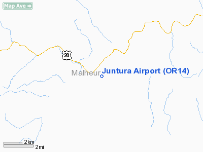
Location & QuickFacts
| FAA Information Effective: | 2008-09-25 |
| Airport Identifier: | OR14 |
| Airport Status: | Operational |
| Longitude/Latitude: | 118-03-48.6450W/43-44-29.5670N
-118.063513/43.741546 (Estimated) |
| Elevation: | 3034 ft / 924.76 m (Surveyed) |
| Land: | 0 acres |
| From nearest city: | 1 nautical miles S of Juntura, OR |
| Location: | Malheur County, OR |
| Magnetic Variation: | 18E (1985) |
Owner & Manager
| Ownership: | Publicly owned |
| Owner: | Blm
BUREAU OF LAND MGMNT, JUNTURA GUARD STATION. |
| Address: | Blm Box 700
Vale, OR 97918 |
| Phone number: | 503-473-3144 |
| Manager: | George House |
| Address: | Blm Box 700
Vale, OR 97918 |
| Phone number: | 503-473-3144 |
Airport Operations and Facilities
| Airport Use: | Private |
| Wind indicator: | Yes |
| Segmented Circle: | No |
| Control Tower: | No |
| Landing fee charge: | No |
| Sectional chart: | Klamath Falls |
| Region: | ANM - Northwest Mountain |
| Boundary ARTCC: | ZLC - Salt Lake City |
| Tie-in FSS: | MMV - Mc Minnville |
| FSS on Airport: | No |
| FSS Toll Free: | 1-800-WX-BRIEF |
Airport Services
| Airframe Repair: | NONE |
| Power Plant Repair: | NONE |
Runway Information
Runway 03/21
| Dimension: | 1500 x 30 ft / 457.2 x 9.1 m |
| Surface: | GRVL-DIRT, |
| |
Runway 03 |
Runway 21 |
| Traffic Pattern: | Left | Left |
|
Radio Navigation Aids
| ID |
Type |
Name |
Ch |
Freq |
Var |
Dist |
| ONO | NDB | Ontario | | 305.00 | 17E | 48.7 nm |
| ILR | VOR/DME | Wildhorse | 085X | 113.80 | 18E | 39.8 nm |
Remarks
- FILED FOR RECORD PURPOSES ONLY.
Images and information placed above are from
http://www.airport-data.com/airport/OR14/
We thank them for the data!
| General Info
|
| Country |
United States
|
| State |
OREGON
|
| FAA ID |
OR14
|
| Latitude |
43-44-29.567N
|
| Longitude |
118-03-48.645W
|
| Elevation |
3034 feet
|
| Near City |
JUNTURA
|
We don't guarantee the information is fresh and accurate. The data may
be wrong or outdated.
For more up-to-date information please refer to other sources.
|
|


