|
|
| Joseph State Airport |
 |
| IATA: none – ICAO: KJSY – FAA LID: JSY |
| Summary |
| Airport type |
Public |
| Owner |
Oregon Department of Aviation |
| Serves |
Joseph, Oregon |
| Elevation AMSL |
4,121 ft / 1,256 m |
| Coordinates |
45°21′34″N 117°15′14″W / 45.35944°N 117.25389°W / 45.35944; -117.25389 |
| Runways |
| Direction |
Length |
Surface |
| ft |
m |
| 15/33 |
5,200 |
1,585 |
Asphalt |
| Statistics (2009) |
| Aircraft operations |
3,850 |
| Based aircraft |
13 |
| Source: Federal Aviation Administration |
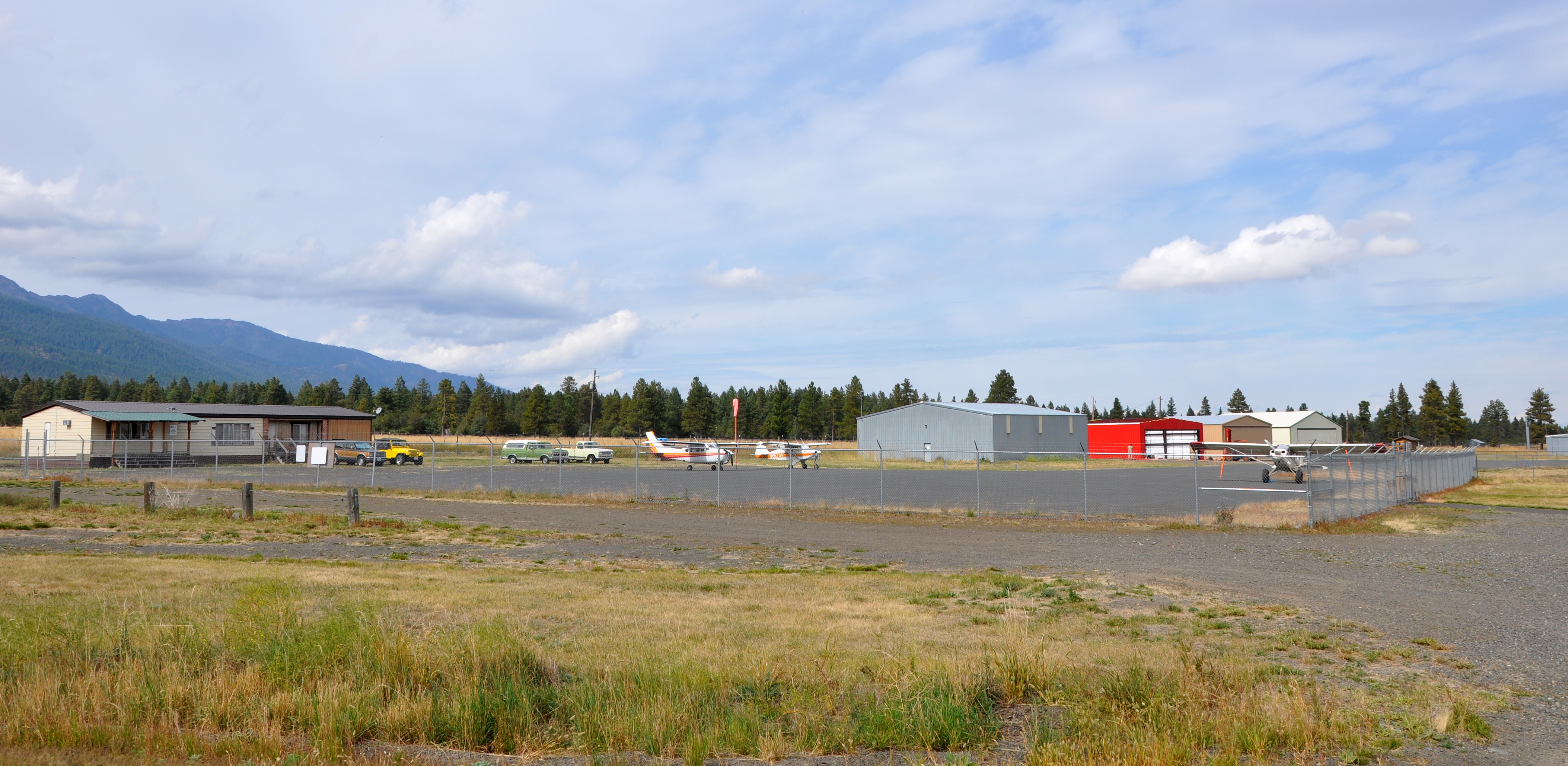
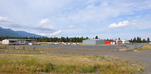
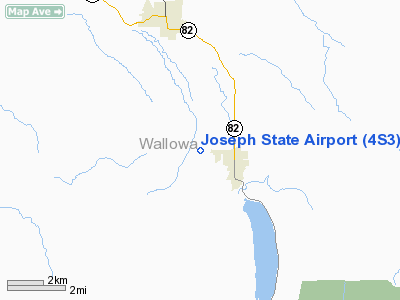
Joseph State Airport (ICAO: KJSY, FAA LID: JSY, formerly 4S3) is a public use airport located one nautical mile (1.85 km) west of the central business district of Joseph, a city in Wallowa County, Oregon, United States. It is owned by the Oregon Department of Aviation.
Commercial flights are not currently available to Joseph. The nearest commercial flights are at the Eastern Oregon Regional Airport in Pendleton.
Although many U.S. airports use the same three-letter location identifier for the FAA and IATA, this airport is assigned JSY by the FAA but has no designation from the IATA (which assigned JSY to Syros Island National Airport on Syros Island in Greece).
Facilities and aircraft
Joseph State Airport covers an area of 103 acres (42 ha) at an elevation of 4,121 feet (1,256 m) above mean sea level. It has one runway designated 15/33 with an asphalt surface measuring 5,200 by 60 feet (1,585 x 18 m). The airport has automatic lighting and no control tower.
For the 12-month period ending April 27, 2009, the airport had 3,850 aircraft operations, an average of 10 per day: 93.5% general aviation and 6.5% air taxi. At that time there were 13 aircraft based at this airport: 92% single-engine and 8% helicopter.
The above content comes from Wikipedia and is published under free licenses – click here to read more.
Location & QuickFacts
| FAA Information Effective: | 2008-09-25 |
| Airport Identifier: | 4S3 |
| Airport Status: | Operational |
| Longitude/Latitude: | 117-15-13.8100W/45-21-34.3800N
-117.253836/45.359550 (Estimated) |
| Elevation: | 4121 ft / 1256.08 m (Surveyed) |
| Land: | 103 acres |
| From nearest city: | 1 nautical miles W of Joseph, OR |
| Location: | Wallowa County, OR |
| Magnetic Variation: | 18E (1985) |
Owner & Manager
| Ownership: | Publicly owned |
| Owner: | Oregon Dept. Of Aviation |
| Address: | 3040 25th St Se
Salem, OR 97302-1125 |
| Phone number: | 503-378-4880 |
| Manager: | State Airports Mgr |
| Address: | 3040 25th St Se
Salem, OR 97302-1125 |
| Phone number: | 503-378-4880 |
Airport Operations and Facilities
| Airport Use: | Open to public |
| Wind indicator: | Yes |
| Segmented Circle: | Yes |
| Control Tower: | No |
| Lighting Schedule: | DUSK-DAWN
ACTVT MIRL RY 15/33, PAPI AND REIL RY 15 - CTAF. |
| Beacon Color: | Clear-Green (lighted land airport) |
| Landing fee charge: | No |
| Sectional chart: | Seattle |
| Region: | ANM - Northwest Mountain |
| Traffic Pattern Alt: | 1000 ft |
| Boundary ARTCC: | ZSE - Seattle |
| Tie-in FSS: | MMV - Mc Minnville |
| FSS on Airport: | No |
| FSS Toll Free: | 1-800-WX-BRIEF |
| NOTAMs Facility: | MMV (NOTAM-d service avaliable) |
| Federal Agreements: | NGY |
Airport Communications
| CTAF: | 122.800 |
| Unicom: | 122.800
UNICOM UNATNDD |
Airport Services
| Fuel available: | 100LLA |
| Airframe Repair: | NONE |
| Power Plant Repair: | NONE |
| Bottled Oxygen: | NONE |
| Bulk Oxygen: | NONE |
Runway Information
Runway 15/33
| Dimension: | 5200 x 60 ft / 1585.0 x 18.3 m |
| Surface: | ASPH, Good Condition |
| Weight Limit: | Single wheel: 12500 lbs. |
| Edge Lights: | Medium |
| |
Runway 15 |
Runway 33 |
| Longitude: | 117-15-22.0760W | 117-15-05.5400W |
| Latitude: | 45-21-59.3789N | 45-21-09.3789N |
| Elevation: | 4063.00 ft | 4121.00 ft |
| Alignment: | 127 | 0 |
| Traffic Pattern: | Left | Left |
| Markings: | Basic, Fair Condition | Basic, Fair Condition |
| Crossing Height: | 43.00 ft | 0.00 ft |
| VASI: | 2-light PAPI on left side | |
| Visual Glide Angle: | 4.00° | 0.00° |
| Runway End Identifier: | Yes | |
| Obstruction: | 31 ft trees, 450.0 ft from runway, 30 ft right of centerline, 8:1 slope to clear | 32 ft pline, 1100.0 ft from runway, 28:1 slope to clear |
|
Radio Navigation Aids
| ID |
Type |
Name |
Ch |
Freq |
Var |
Dist |
| LGD | NDB | La Grande | | 296.00 | 17E | 30.0 nm |
| BKE | VOR/DME | Baker City | 100X | 115.30 | 20E | 39.1 nm |
Remarks
- USE EXTREME CAUTION DURING SOUTH TAKEOFFS DUE POSSIBLE HAZARDOUS DOWNDRAFTS SOUTH OF ARPT UNDER SOUTH WND CONDITIONS.
- DEER ON ARPT ALL HRS.
Images and information placed above are from
http://www.airport-data.com/airport/4S3/
We thank them for the data!
| General Info
|
| Country |
United States
|
| State |
OREGON
|
| FAA ID |
4S3
|
| Latitude |
45-21-25.545N
|
| Longitude |
117-15-11.608W
|
| Elevation |
4122 feet
|
| Near City |
JOSEPH
|
We don't guarantee the information is fresh and accurate. The data may
be wrong or outdated.
For more up-to-date information please refer to other sources.
|
|