|
|
Independence State Airport |
Coordinates: 44°52′01″N 123°11′54″W / 44.86694°N 123.19833°W / 44.86694; -123.19833
Independence State Airport
Independence Airpark |
 |
| IATA: none – ICAO: none – FAA LID: 7S5 |
| Summary |
| Airport type |
Public |
| Owner |
Oregon Department of Aviation |
| Serves |
Independence, Oregon |
| Elevation AMSL |
180 ft / 55 m |
| Runways |
| Direction |
Length |
Surface |
| ft |
m |
| 16/34 |
2,935 |
895 |
Asphalt |
| Statistics (1999) |
| Aircraft operations |
31,658 |
| Based aircraft |
142 |
| Source: Federal Aviation Administration |
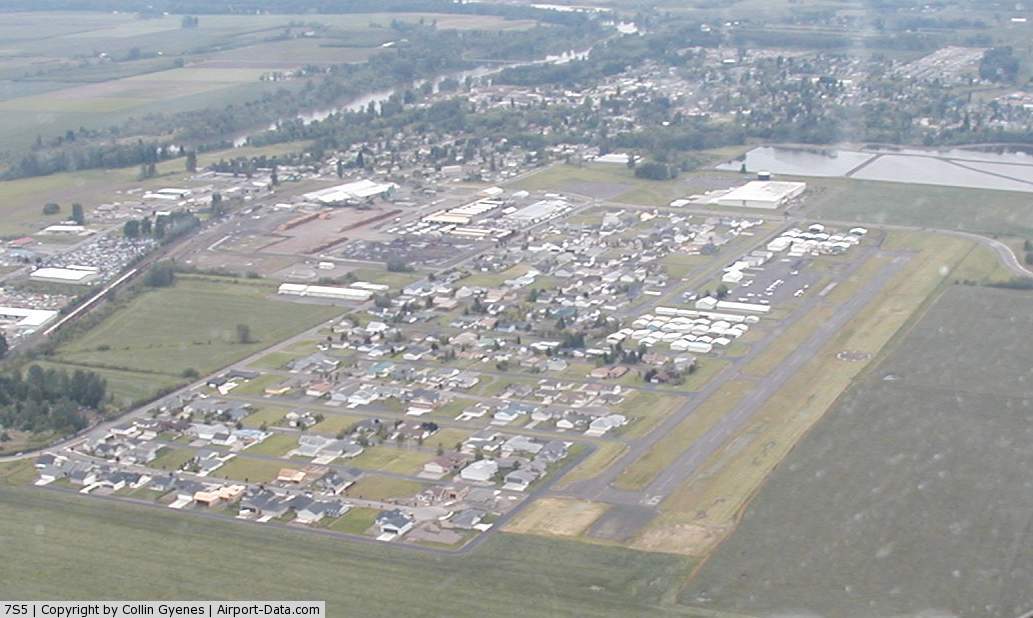
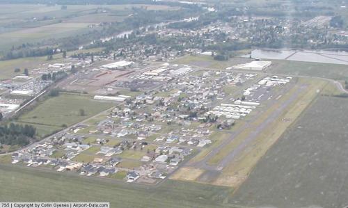
Independence State Airport (FAA LID: 7S5) is a public-use airport located one mile (1.6 km) northwest of the central business district of Independence, a city in Polk County, Oregon, United States. It is owned by the Oregon Department of Aviation.
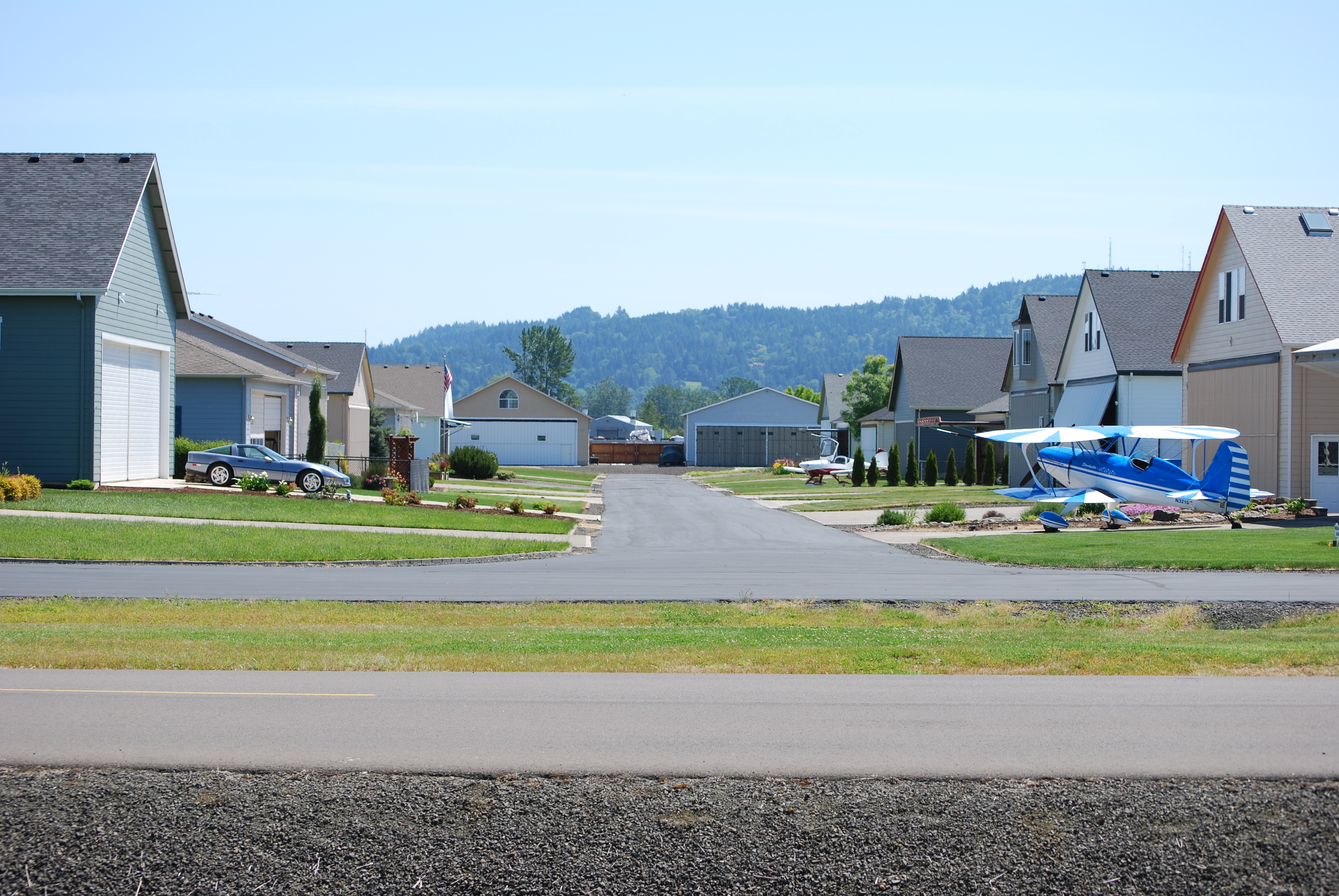
Serving as a general aviation airport, Independence also hosts a large residential airpark. This facility has two claims to fame as Oregon's only Public Use airport hosting an airpark in addition to the only state owned airpark.
Facilities and aircraft
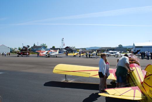
Independence State Airport covers an area of 69 acres (28 ha) which contains one runway designated 16/34 with a 2,935 x 60 ft (895 x 18 m) asphalt pavement. For the 12-month period ending October 18, 1999, the airport had 31,658 aircraft operations, an average of 86 per day: 96% general aviation and 4% air taxi. At that time there were 142 aircraft based at this airport: 94% single-engine, 2% multi-engine and 4% ultralight. The Starduster Cafe on the airport serves breakfast, lunch, and dinner.
The above content comes from Wikipedia and is published under free licenses – click here to read more.

 |
(Click on the photo to enlarge) |
Location & QuickFacts
| FAA Information Effective: | 2008-09-25 |
| Airport Identifier: | 7S5 |
| Airport Status: | Operational |
| Longitude/Latitude: | 123-11-53.6900W/44-52-01.0500N
-123.198247/44.866958 (Estimated) |
| Elevation: | 180 ft / 54.86 m (Surveyed) |
| Land: | 69 acres |
| From nearest city: | 1 nautical miles NW of Independence, OR |
| Location: | Polk County, OR |
| Magnetic Variation: | 19E (1985) |
Owner & Manager
| Ownership: | Publicly owned |
| Owner: | Oregon Department Of Aviation |
| Address: | 3040 25th St Se
Salem, OR 97302 |
| Phone number: | 503-378-8689 |
| Manager: | Tom Franklin |
| Address: | 3040 25th St Se
Salem, OR 97302-1125 |
| Phone number: | 503-378-8689 |
Airport Operations and Facilities
| Airport Use: | Open to public |
| Wind indicator: | Yes |
| Segmented Circle: | Yes |
| Control Tower: | No |
| Lighting Schedule: | DUSK-DAWN
ACTVT MIRL RY 16/34, PAPI RY 16 & RY 34 - CTAF. |
| Beacon Color: | Clear-Green (lighted land airport) |
| Landing fee charge: | No |
| Sectional chart: | Seattle |
| Region: | ANM - Northwest Mountain |
| Traffic Pattern Alt: | 1000 ft |
| Boundary ARTCC: | ZSE - Seattle |
| Tie-in FSS: | MMV - Mc Minnville |
| FSS on Airport: | No |
| FSS Toll Free: | 1-800-WX-BRIEF |
| NOTAMs Facility: | MMV (NOTAM-d service avaliable) |
| Federal Agreements: | NGY |
Airport Communications
| CTAF: | 122.800 |
| Unicom: | 122.800 |
Airport Services
| Fuel available: | 100LL80 |
| Airframe Repair: | NONE |
| Power Plant Repair: | NONE |
| Bottled Oxygen: | NONE |
| Bulk Oxygen: | NONE |
Runway Information
Runway 16/34
| Dimension: | 3142 x 60 ft / 957.7 x 18.3 m |
| Surface: | ASPH, Good Condition |
| Weight Limit: | Single wheel: 12500 lbs. |
| Edge Lights: | Medium |
| |
Runway 16 |
Runway 34 |
| Longitude: | 123-11-53.7210W | 123-11-53.6577W |
| Latitude: | 44-52-16.5639N | 44-51-45.5369N |
| Elevation: | 179.00 ft | 179.00 ft |
| Alignment: | 127 | 127 |
| Traffic Pattern: | Left | Left |
| Markings: | Basic, Good Condition | Basic, Good Condition |
| Crossing Height: | 40.00 ft | 40.00 ft |
| Displaced threshold: | 0.00 ft | 140.00 ft |
| VASI: | 4-light PAPI on right side | 4-light PAPI on left side |
| Visual Glide Angle: | 3.00° | 3.00° |
| Obstruction: | 61 ft pline, 2240.0 ft from runway, 250 ft right of centerline, 33:1 slope to clear | 15 ft road, 410.0 ft from runway, 14:1 slope to clear |
|
Radio Navigation Aids
| ID |
Type |
Name |
Ch |
Freq |
Var |
Dist |
| LWG | NDB | Lewisburg | | 225.00 | 18E | 15.5 nm |
| EU | NDB | Frakk | | 260.00 | 19E | 39.3 nm |
| PND | NDB | Banks | | 356.00 | 21E | 46.3 nm |
| CBU | TACAN | Columbia | 029X | | 20E | 50.0 nm |
| CVO | VOR/DME | Corvallis | 101X | 115.40 | 18E | 22.5 nm |
| UBG | VOR/DME | Newberg | 121X | 117.40 | 21E | 30.7 nm |
| ONP | VORTAC | Newport | 118X | 117.10 | 19E | 40.8 nm |
| EUG | VORTAC | Eugene | 076X | 112.90 | 20E | 44.9 nm |
| HIO | VOT | Portland-hillsboro | | 115.20 | | 41.8 nm |
Remarks
- ULTRALIGHT ACFT ON AND INVOF ARPT.
- MIGRATORY FLOCKS OF WATERFOWL ON AND INVOF ARPT.
Images and information placed above are from
http://www.airport-data.com/airport/7S5/
We thank them for the data!
| General Info
|
| Country |
United States
|
| State |
OREGON
|
| FAA ID |
7S5
|
| Latitude |
44-52-00.352N
|
| Longitude |
123-11-53.691W
|
| Elevation |
176 feet
|
| Near City |
INDEPENDENCE
|
We don't guarantee the information is fresh and accurate. The data may
be wrong or outdated.
For more up-to-date information please refer to other sources.
|
|