 |
|
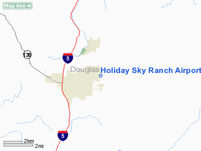
Holiday Sky Ranch Airport |
Location & QuickFacts
| FAA Information Effective: | 2008-09-25 |
| Airport Identifier: | 11OR |
| Airport Status: | Operational |
| Longitude/Latitude: | 123-17-07.2700W/43-23-36.4240N
-123.285353/43.393451 (Estimated) |
| Elevation: | 510 ft / 155.45 m (Estimated) |
| Land: | 0 acres |
| From nearest city: | 1 nautical miles E of Sutherlin, OR |
| Location: | Douglas County, OR |
| Magnetic Variation: | 18E (1990) |
Owner & Manager
| Ownership: | Privately owned |
| Owner: | Doug Dense |
| Address: | 2089 Nonpareil Road
Sutherlin, OR 97479 |
| Phone number: | 503-459-5222 |
| Manager: | Doug Dense |
| Address: | 2089 Nonpareil Road
Sutherlin, OR 97479 |
| Phone number: | 503-459-9867 |
Airport Operations and Facilities
| Airport Use: | Private |
| Wind indicator: | Yes |
| Segmented Circle: | Yes |
| Control Tower: | No |
| Sectional chart: | Klamath Falls |
| Region: | ANM - Northwest Mountain |
| Boundary ARTCC: | ZSE - Seattle |
| Tie-in FSS: | MMV - Mc Minnville |
| FSS Toll Free: | 1-800-WX-BRIEF |
Runway Information
Runway 05/23
| Dimension: | 2225 x 40 ft / 678.2 x 12.2 m |
| Surface: | TURF, Fair Condition |
| |
Runway 05 |
Runway 23 |
| Traffic Pattern: | Left | Left |
| Obstruction: | | 4 ft fence, 40.0 ft from runway |
|
Radio Navigation Aids
| ID |
Type |
Name |
Ch |
Freq |
Var |
Dist |
| RBG | NDB | Roseburg | | 400.00 | 20E | 10.0 nm |
| EU | NDB | Frakk | | 260.00 | 19E | 49.3 nm |
| RBG | VOR/DME | Roseburg | 019X | 108.20 | 20E | 13.0 nm |
| OTH | VORTAC | North Bend | 058X | 112.10 | 18E | 38.6 nm |
| EUG | VORTAC | Eugene | 076X | 112.90 | 20E | 43.8 nm |
Remarks
- FENCE AND BUSHES 50 FT SOUTH FROM RY CENTERLINE.
Images and information placed above are from
http://www.airport-data.com/airport/11OR/
We thank them for the data!
| General Info
|
| Country |
United States
|
| State |
OREGON
|
| FAA ID |
11OR
|
| Latitude |
43-23-36.424N
|
| Longitude |
123-17-07.270W
|
| Elevation |
510 feet
|
| Near City |
SUTHERLIN
|
We don't guarantee the information is fresh and accurate. The data may
be wrong or outdated.
For more up-to-date information please refer to other sources.
|
|


