 |
|
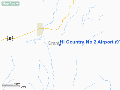
Location & QuickFacts
| FAA Information Effective: | 2008-09-25 |
| Airport Identifier: | 97OR |
| Airport Status: | Operational |
| Longitude/Latitude: | 118-39-44.8050W/44-26-06.5700N
-118.662446/44.435158 (Estimated) |
| Elevation: | 3840 ft / 1170.43 m (Estimated) |
| Land: | 40 acres |
| From nearest city: | 3 nautical miles SE of Prairie City, OR |
| Location: | Grant County, OR |
| Magnetic Variation: | 18E (1985) |
Owner & Manager
| Ownership: | Privately owned |
| Owner: | Del Raymond |
| Address: | Rt 2 Box 571
Prairie City, OR 97869 |
| Phone number: | 503-820-3309 |
| Manager: | Del Raymond |
| Address: | Rt 2 Box 571
Prairie City, OR 97869 |
| Phone number: | 503-820-3309 |
Airport Operations and Facilities
| Airport Use: | Private |
| Wind indicator: | Yes |
| Segmented Circle: | No |
| Control Tower: | No |
| Sectional chart: | Klamath Falls |
| Region: | ANM - Northwest Mountain |
| Boundary ARTCC: | ZLC - Salt Lake City |
| Tie-in FSS: | MMV - Mc Minnville |
| FSS Toll Free: | 1-800-WX-BRIEF |
Runway Information
Runway 14/32
| Dimension: | 2500 x 50 ft / 762.0 x 15.2 m |
| Surface: | GRVL-DIRT, |
| |
Runway 14 |
Runway 32 |
| Traffic Pattern: | Left | Left |
|
Radio Navigation Aids
| ID |
Type |
Name |
Ch |
Freq |
Var |
Dist |
| BKE | VOR/DME | Baker City | 100X | 115.30 | 20E | 43.9 nm |
| IMB | VORTAC | Kimberly | 103X | 115.60 | 20E | 46.7 nm |
Images and information placed above are from
http://www.airport-data.com/airport/97OR/
We thank them for the data!
| General Info
|
| Country |
United States
|
| State |
OREGON
|
| FAA ID |
97OR
|
| Latitude |
44-26-06.570N
|
| Longitude |
118-39-44.805W
|
| Elevation |
3840 feet
|
| Near City |
PRAIRIE CITY
|
We don't guarantee the information is fresh and accurate. The data may
be wrong or outdated.
For more up-to-date information please refer to other sources.
|
|


