 |
|
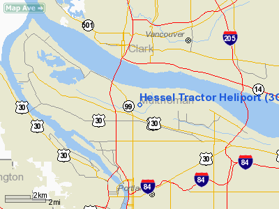
Location & QuickFacts
| FAA Information Effective: | 2008-09-25 |
| Airport Identifier: | 3OR3 |
| Airport Status: | Operational |
| Longitude/Latitude: | 122-39-14.3470W/45-35-19.4230N
-122.653985/45.588729 (Estimated) |
| Elevation: | 284 ft / 86.56 m (Estimated) |
| Land: | 0 acres |
| From nearest city: | 0 nautical miles N of Portland, OR |
| Location: | Multnomah County, OR |
| Magnetic Variation: | 19E (1985) |
Owner & Manager
| Ownership: | Privately owned |
| Owner: | Jack Hessel |
| Address: | 1425 Ne Columbia Blvd
Portland, OR 97211 |
| Phone number: | 503-289-1103 |
| Manager: | Jack Hessel |
| Address: | 1425 Ne Columbia Blvd
Portland, OR 97211 |
| Phone number: | 503-289-1103 |
Airport Operations and Facilities
| Airport Use: | Private |
| Wind indicator: | Yes |
| Segmented Circle: | No |
| Control Tower: | No |
| Landing fee charge: | No |
| Sectional chart: | Seattle |
| Region: | ANM - Northwest Mountain |
| Boundary ARTCC: | ZSE - Seattle |
| Tie-in FSS: | MMV - Mc Minnville |
| FSS on Airport: | No |
| FSS Toll Free: | 1-800-WX-BRIEF |
Runway Information
Helipad H1
| Dimension: | 40 x 40 ft / 12.2 x 12.2 m |
| Surface: | CONC, |
| |
Runway H1 |
Runway |
| Traffic Pattern: | Left | Left |
|
Radio Navigation Aids
| ID |
Type |
Name |
Ch |
Freq |
Var |
Dist |
| LBH | NDB | Laker | | 332.00 | 20E | 8.6 nm |
| PND | NDB | Banks | | 356.00 | 21E | 16.7 nm |
| LSO | NDB | Kelso | | 256.00 | 21E | 35.7 nm |
| CBU | TACAN | Columbia | 029X | | 20E | 1.8 nm |
| PDX | VOR/DME | Portland | 055X | 111.80 | 20E | 2.0 nm |
| UBG | VOR/DME | Newberg | 121X | 117.40 | 21E | 19.7 nm |
| BTG | VORTAC | Battle Ground | 113X | 116.60 | 21E | 9.9 nm |
| PDX | VOT | Portland Intl | | 111.00 | | 2.3 nm |
| HIO | VOT | Portland-hillsboro | | 115.20 | | 12.7 nm |
Remarks
- ESTABMT OF RDO CTC WITH PORTLAND TWR BEFORE ENTERING CTLZ & BEFORE DEPG FROM HEL. A LETTER OF AGREEMENT WITH PORTLAND TWR GOVERNING VFR & SPL VFR HEL OPNS IS ESTABD. MUTUALLY SATFY AGREEMENT WITH OPERATOR OF TOWN CONCRETE PIPE HELIPORT.
Images and information placed above are from
http://www.airport-data.com/airport/3OR3/
We thank them for the data!
| General Info
|
| Country |
United States
|
| State |
OREGON
|
| FAA ID |
3OR3
|
| Latitude |
45-35-19.423N
|
| Longitude |
122-39-14.347W
|
| Elevation |
284 feet
|
| Near City |
PORTLAND
|
We don't guarantee the information is fresh and accurate. The data may
be wrong or outdated.
For more up-to-date information please refer to other sources.
|
|


