 |
|
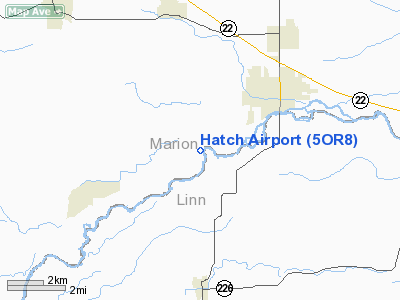
Location & QuickFacts
| FAA Information Effective: | 2008-09-25 |
| Airport Identifier: | 5OR8 |
| Airport Status: | Operational |
| Longitude/Latitude: | 122-51-00.3240W/44-46-23.4380N
-122.850090/44.773177 (Estimated) |
| Elevation: | 380 ft / 115.82 m (Estimated) |
| Land: | 0 acres |
| From nearest city: | 3 nautical miles SW of Stayton, OR |
| Location: | Marion County, OR |
| Magnetic Variation: | 19E (1985) |
Owner & Manager
| Ownership: | Privately owned |
| Owner: | Everett W Hatch |
| Address: | 12292 Hatch Lane Se
Aumsville, OR 97325 |
| Phone number: | 503-769-7188 |
| Address: |
|
Airport Operations and Facilities
| Airport Use: | Private |
| Wind indicator: | Yes |
| Segmented Circle: | No |
| Control Tower: | No |
| Lighting Schedule: | PHONE REQ
FOR LIRL RWY 15/33 CALL - 503-769-7188. |
| Landing fee charge: | No |
| Sectional chart: | Seattle |
| Region: | ANM - Northwest Mountain |
| Boundary ARTCC: | ZSE - Seattle |
| Tie-in FSS: | MMV - Mc Minnville |
| FSS on Airport: | No |
| FSS Toll Free: | 1-800-WX-BRIEF |
Airport Services
| Airframe Repair: | NONE |
| Power Plant Repair: | NONE |
Runway Information
Runway 15/33
| Dimension: | 2500 x 50 ft / 762.0 x 15.2 m |
| Surface: | TURF-GRVL, |
| Edge Lights: | Low |
| |
Runway 15 |
Runway 33 |
| Traffic Pattern: | Left | Left |
|
Radio Navigation Aids
| ID |
Type |
Name |
Ch |
Freq |
Var |
Dist |
| LWG | NDB | Lewisburg | | 225.00 | 18E | 20.4 nm |
| EU | NDB | Frakk | | 260.00 | 19E | 37.2 nm |
| LBH | NDB | Laker | | 332.00 | 20E | 49.0 nm |
| CVO | VOR/DME | Corvallis | 101X | 115.40 | 18E | 25.1 nm |
| UBG | VOR/DME | Newberg | 121X | 117.40 | 21E | 35.3 nm |
| EUG | VORTAC | Eugene | 076X | 112.90 | 20E | 42.3 nm |
| HIO | VOT | Portland-hillsboro | | 115.20 | | 46.3 nm |
Images and information placed above are from
http://www.airport-data.com/airport/5OR8/
We thank them for the data!
| General Info
|
| Country |
United States
|
| State |
OREGON
|
| FAA ID |
5OR8
|
| Latitude |
44-46-23.438N
|
| Longitude |
122-51-00.324W
|
| Elevation |
380 feet
|
| Near City |
STAYTON
|
We don't guarantee the information is fresh and accurate. The data may
be wrong or outdated.
For more up-to-date information please refer to other sources.
|
|


