 |
|
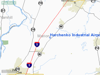
Harchenko Industrial Airport |
Location & QuickFacts
| FAA Information Effective: | 2008-09-25 |
| Airport Identifier: | OR38 |
| Airport Status: | Operational |
| Longitude/Latitude: | 122-55-44.3440W/45-04-39.4300N
-122.928984/45.077619 (Estimated) |
| Elevation: | 183 ft / 55.78 m (Estimated) |
| Land: | 28 acres |
| From nearest city: | 3 nautical miles NE of Brooks, OR |
| Location: | Marion County, OR |
| Magnetic Variation: | 19E (1985) |
Owner & Manager
| Ownership: | Privately owned |
| Owner: | Jerral D. Harchenko |
| Address: | 6736 Waconda Rd Ne
Salem, OR 97305 |
| Phone number: | 503-393-7401 |
| Manager: | Jerral D. Harchenko |
| Address: | 6736 Waconda Rd Ne
Salem, OR 97305 |
| Phone number: | 503-393-7401 |
Airport Operations and Facilities
| Airport Use: | Private |
| Wind indicator: | Yes |
| Segmented Circle: | No |
| Control Tower: | No |
| Landing fee charge: | No |
| Sectional chart: | Seattle |
| Region: | ANM - Northwest Mountain |
| Boundary ARTCC: | ZSE - Seattle |
| Tie-in FSS: | MMV - Mc Minnville |
| FSS on Airport: | No |
| FSS Toll Free: | 1-800-WX-BRIEF |
Airport Services
| Airframe Repair: | NONE |
| Power Plant Repair: | NONE |
Runway Information
Runway 07/25
| Dimension: | 2290 x 75 ft / 698.0 x 22.9 m |
| Surface: | ASPH-GRVL,
EAST 2000' ASPH' WEST 290' GRVL. |
| |
Runway 07 |
Runway 25 |
| Traffic Pattern: | Left | Left |
| Obstruction: | 15 ft pline, 200.0 ft from runway | 40 ft pline, 30.0 ft from runway |
|
Radio Navigation Aids
| ID |
Type |
Name |
Ch |
Freq |
Var |
Dist |
| LWG | NDB | Lewisburg | | 225.00 | 18E | 31.5 nm |
| PND | NDB | Banks | | 356.00 | 21E | 33.6 nm |
| LBH | NDB | Laker | | 332.00 | 20E | 34.1 nm |
| CBU | TACAN | Columbia | 029X | | 20E | 33.5 nm |
| UBG | VOR/DME | Newberg | 121X | 117.40 | 21E | 16.7 nm |
| PDX | VOR/DME | Portland | 055X | 111.80 | 20E | 33.9 nm |
| CVO | VOR/DME | Corvallis | 101X | 115.40 | 18E | 38.1 nm |
| BTG | VORTAC | Battle Ground | 113X | 116.60 | 21E | 42.7 nm |
| HIO | VOT | Portland-hillsboro | | 115.20 | | 27.8 nm |
| PDX | VOT | Portland Intl | | 111.00 | | 34.2 nm |
Remarks
- RESTRICTED BY THE STATE BOARD OF AERONAUTICS TO E LANDINGS & W TAKEOFFS DUE TOPLINES ON E END.
- RESTRICTED BY THE MARION CO BOARD OF COMMISSIONERS TO AGRICULTURAL ORIENTATED ACTIVITIES ONLY.
- MULTICOM 122.85.
Images and information placed above are from
http://www.airport-data.com/airport/OR38/
We thank them for the data!
| General Info
|
| Country |
United States
|
| State |
OREGON
|
| FAA ID |
OR38
|
| Latitude |
45-04-39.430N
|
| Longitude |
122-55-44.344W
|
| Elevation |
183 feet
|
| Near City |
BROOKS
|
We don't guarantee the information is fresh and accurate. The data may
be wrong or outdated.
For more up-to-date information please refer to other sources.
|
|


