 |
|
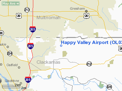
Location & QuickFacts
| FAA Information Effective: | 2008-09-25 |
| Airport Identifier: | OL03 |
| Airport Status: | Operational |
| Longitude/Latitude: | 122-29-58.3230W/45-26-53.4340N
-122.499534/45.448176 (Estimated) |
| Elevation: | 797 ft / 242.93 m (Estimated) |
| Land: | 10 acres |
| From nearest city: | 2 nautical miles SE of Happy Valley, OR |
| Location: | Clackamas County, OR |
| Magnetic Variation: | 19E (1985) |
Owner & Manager
| Ownership: | Privately owned |
| Owner: | Larry Burright |
| Address: | 8740 Se 155th
Portland, OR 97236 |
| Phone number: | 503-761-3333 |
| Manager: | Larry Burright |
| Address: | 8740 Se 155th
Portland, OR 97236 |
| Phone number: | 503-761-3333 |
Airport Operations and Facilities
| Airport Use: | Private |
| Wind indicator: | Yes |
| Segmented Circle: | No |
| Control Tower: | No |
| Lighting Schedule: | PHONE REQ
FOR LIRL RWY 16/34 CALL 503-761-5555. |
| Landing fee charge: | No |
| Sectional chart: | Seattle |
| Region: | ANM - Northwest Mountain |
| Traffic Pattern Alt: | 1000 ft |
| Boundary ARTCC: | ZSE - Seattle |
| Tie-in FSS: | MMV - Mc Minnville |
| FSS on Airport: | No |
| FSS Toll Free: | 1-800-WX-BRIEF |
Airport Services
| Airframe Repair: | NONE |
| Power Plant Repair: | NONE |
| Bottled Oxygen: | NONE |
| Bulk Oxygen: | NONE |
Runway Information
Runway 16/34
| Dimension: | 2264 x 25 ft / 690.1 x 7.6 m |
| Surface: | ASPH, |
| Edge Lights: | Low |
| |
Runway 16 |
Runway 34 |
| Traffic Pattern: | Left | Right |
| Markings: | None, | None, |
| Obstruction: | 25 ft trees, 400.0 ft from runway, 15:1 slope to clear | 10 ft trees, 200.0 ft from runway, 20:1 slope to clear
+25' TREES 150' LEFT. |
|
Radio Navigation Aids
| ID |
Type |
Name |
Ch |
Freq |
Var |
Dist |
| LBH | NDB | Laker | | 332.00 | 20E | 5.8 nm |
| PND | NDB | Banks | | 356.00 | 21E | 25.5 nm |
| LSO | NDB | Kelso | | 256.00 | 21E | 45.9 nm |
| CBU | TACAN | Columbia | 029X | | 20E | 9.7 nm |
| PDX | VOR/DME | Portland | 055X | 111.80 | 20E | 9.8 nm |
| UBG | VOR/DME | Newberg | 121X | 117.40 | 21E | 21.0 nm |
| BTG | VORTAC | Battle Ground | 113X | 116.60 | 21E | 18.4 nm |
| PDX | VOT | Portland Intl | | 111.00 | | 10.0 nm |
| HIO | VOT | Portland-hillsboro | | 115.20 | | 19.7 nm |
Remarks
- PRVDD TREES AT BOTH ENDS OF RWY ARE REMOVED, OR RWY THS DSPLCD TO PRVD 20-1 OBSTN FREE APCH SFCS.
Images and information placed above are from
http://www.airport-data.com/airport/OL03/
We thank them for the data!
| General Info
|
| Country |
United States
|
| State |
OREGON
|
| FAA ID |
OL03
|
| Latitude |
45-26-53.434N
|
| Longitude |
122-29-58.323W
|
| Elevation |
797 feet
|
| Near City |
HAPPY VALLEY
|
We don't guarantee the information is fresh and accurate. The data may
be wrong or outdated.
For more up-to-date information please refer to other sources.
|
|


