|
|
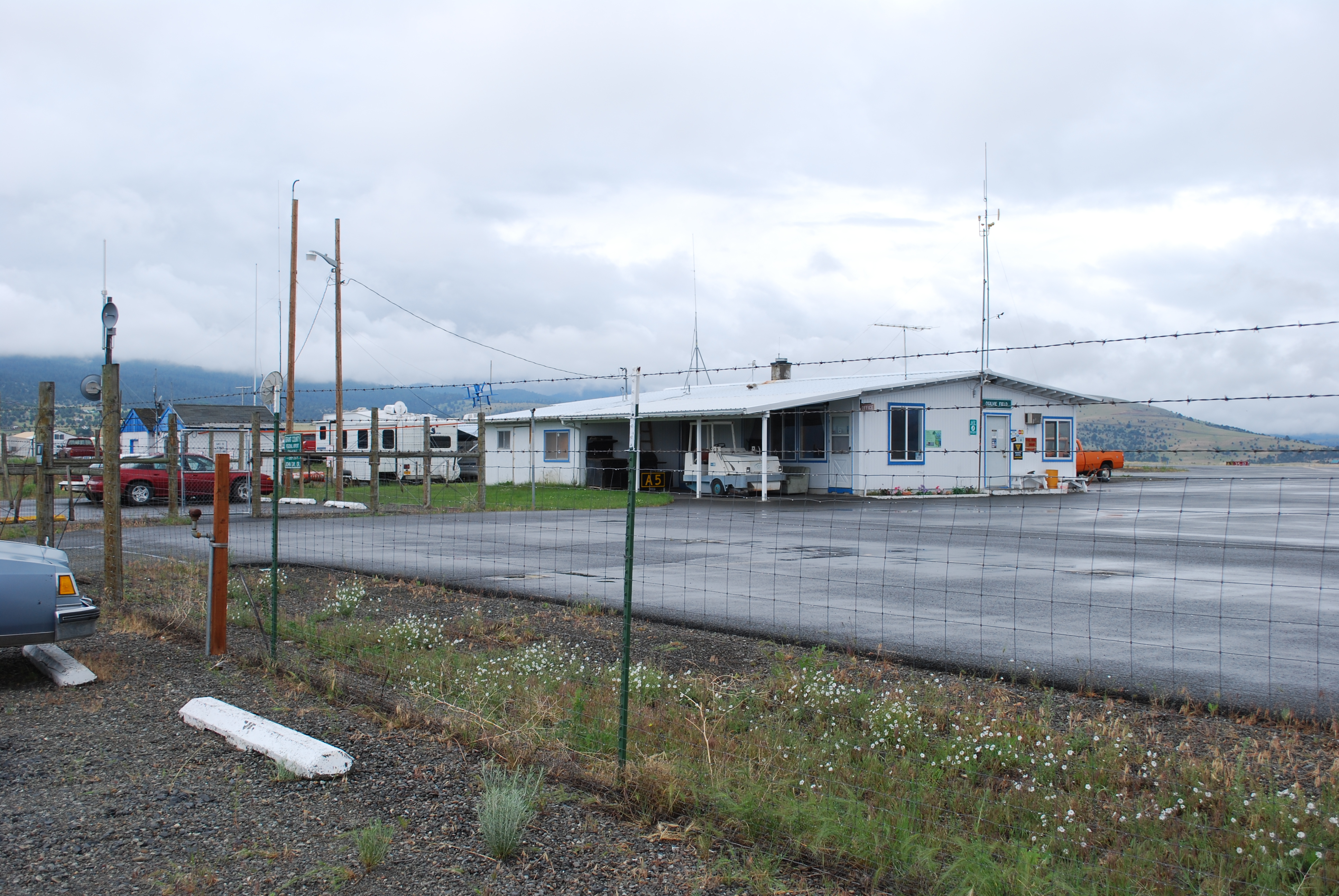
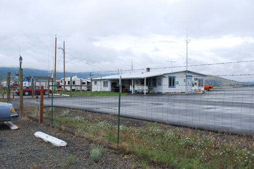
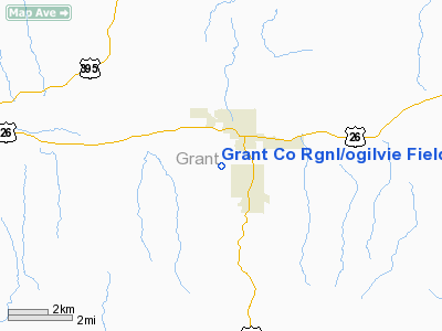
Grant Co Rgnl/ogilvie Field Airport |
Grant County Regional Airport
Ogilvie Field |
 |
| IATA: JDA – ICAO: KGCD |
| Summary |
| Airport type |
Public |
| Operator |
Grant County |
| Location |
John Day, Oregon |
| Elevation AMSL |
3697 ft / 1126.8 m |
| Coordinates |
44°24′15.0000″N 118°57′45.0000″W / 44.40417°N 118.9625°W / 44.40417; -118.9625Coordinates: 44°24′15.0000″N 118°57′45.0000″W / 44.40417°N 118.9625°W / 44.40417; -118.9625 |
| Website |
Grant County Services |
| Runways |
| Direction |
Length |
Surface |
| ft |
m |
| 17/35 |
4500 |
1372 |
Asphalt |
| 9/27 |
3443 |
1049 |
Asphalt |
Grant County Regional Airport (IATA: JDA, ICAO: KGCD), is a public airport located one mile (1.6 km) southwest of John Day in Grant County, Oregon, USA. Grant County Airport previously carried the FAA identifier 5J0.
The above content comes from Wikipedia and is published under free licenses – click here to read more.
Location & QuickFacts
| FAA Information Effective: | 2008-09-25 |
| Airport Identifier: | GCD |
| Airport Status: | Operational |
| Longitude/Latitude: | 118-57-59.9000W/44-24-09.5000N
-118.966639/44.402639 (Estimated) |
| Elevation: | 3701 ft / 1128.06 m (Surveyed) |
| Land: | 335 acres |
| From nearest city: | 1 nautical miles SW of John Day, OR |
| Location: | Grant County, OR |
| Magnetic Variation: | 17E (1995) |
Owner & Manager
| Ownership: | Publicly owned |
| Owner: | Grant County |
| Address: | , 201 S. Humbolt, Ste. 280
Cannon City, OR 97820 |
| Phone number: | 541-575-0059 |
| Manager: | Gary Judd |
| Address: | 720 Airport Road
John Day, OR 97845 |
| Phone number: | 541-575-1151 |
Airport Operations and Facilities
| Airport Use: | Open to public |
| Wind indicator: | Yes |
| Segmented Circle: | Yes |
| Control Tower: | No |
| Lighting Schedule: | DUSK-DAWN
ACTVT LIRL RY 09/27; MIRL RY 17/35; REIL RY 17 & VASI RY 17 - CTAF. |
| Beacon Color: | Clear-Green (lighted land airport) |
| Sectional chart: | Klamath Falls |
| Region: | ANM - Northwest Mountain |
| Boundary ARTCC: | ZSE - Seattle |
| Tie-in FSS: | MMV - Mc Minnville |
| FSS Toll Free: | 1-800-WX-BRIEF |
| NOTAMs Facility: | GCD (NOTAM-d service avaliable) |
| Federal Agreements: | NGY |
Airport Communications
| CTAF: | 122.800 |
| Unicom: | 122.800 |
Airport Services
| Fuel available: | 100LLA
SELF SERVICE FUEL AVBL AFTER HOURS. |
| Airframe Repair: | NONE |
| Power Plant Repair: | NONE |
| Bottled Oxygen: | NONE |
| Bulk Oxygen: | NONE |
Runway Information
Runway 09/27
| Dimension: | 3432 x 60 ft / 1046.1 x 18.3 m |
| Surface: | ASPH, Good Condition |
| Weight Limit: | Single wheel: 12500 lbs. |
| Edge Lights: | Low |
| |
Runway 09 |
Runway 27 |
| Longitude: | 118-58-36.3501W | 118-57-51.9235W |
| Latitude: | 44-24-10.9595N | 44-23-59.4129N |
| Elevation: | 3650.00 ft | 3694.00 ft |
| Alignment: | 110 | 127 |
| Traffic Pattern: | Left | Right |
| Markings: | Non-precision instrument, Fair Condition | Basic, Good Condition |
|
Runway 17/35
| Dimension: | 4500 x 60 ft / 1371.6 x 18.3 m |
| Surface: | ASPH, Good Condition |
| Weight Limit: | Single wheel: 12500 lbs. |
| Edge Lights: | Medium |
| |
Runway 17 |
Runway 35 |
| Longitude: | 118-57-46.8754W | 118-57-51.2398W |
| Latitude: | 44-24-35.0103N | 44-23-50.6963N |
| Elevation: | 3680.00 ft | 3701.00 ft |
| Alignment: | 127 | 4 |
| Traffic Pattern: | Left | Left |
| Markings: | Basic, Good Condition
RYS 17/35 BSC MARKINGS, PLUS AIMING POINT MARKS. | Basic, Good Condition |
| Crossing Height: | 29.00 ft | 0.00 ft |
| VASI: | 2-box on left side | |
| Visual Glide Angle: | 3.00° | 0.00° |
| Runway End Identifier: | Yes | |
|
Radio Navigation Aids
| ID |
Type |
Name |
Ch |
Freq |
Var |
Dist |
| ILR | VOR/DME | Wildhorse | 085X | 113.80 | 18E | 48.7 nm |
| IMB | VORTAC | Kimberly | 103X | 115.60 | 20E | 35.2 nm |
Remarks
- TWY MKD WITH REFLECTORS.
- 8 FT GAME FENCE AROUND ARPT.
- EXTENSIVE HELICOPTER ACTIVITY DURING FIRE SEASON (JUL-OCT).
- BE AWARE OF SOFT EDGES ALONG RYS & TWYS.
- ESTABD PRIOR TO 1959.
Images and information placed above are from
http://www.airport-data.com/airport/GCD/
We thank them for the data!
|
|