 |
|
Location & QuickFacts
| FAA Information Effective: | 2008-09-25 |
| Airport Identifier: | OR29 |
| Airport Status: | Operational |
| Longitude/Latitude: | 121-20-02.1210W/44-06-40.4220N
-121.333922/44.111228 (Estimated) |
| Elevation: | 3480 ft / 1060.70 m (Estimated) |
| Land: | 0 acres |
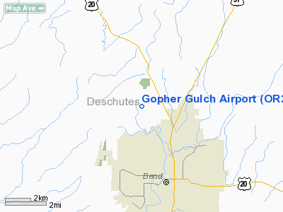
| From nearest city: | 3 nautical miles N of Bend, OR |
| Location: | Deschutes County, OR |
| Magnetic Variation: | 18E (1985) |
Owner & Manager
| Ownership: | Privately owned |
| Owner: | Edward J./doris E. Elkins |
| Address: | 63613 O.b. Riley Rd.
Bend, OR 97701 |
| Phone number: | 503-389-9662 |
| Manager: | Edward Elkins |
| Address: | 63613 O.b. Riley Rd.
Bend, OR 97701 |
| Phone number: | 503-389-9662 |
Airport Operations and Facilities
| Airport Use: | Private |
| Wind indicator: | Yes |
| Segmented Circle: | No |
| Control Tower: | No |
| Landing fee charge: | No |
| Sectional chart: | Klamath Falls |
| Region: | ANM - Northwest Mountain |
| Boundary ARTCC: | ZSE - Seattle |
| Tie-in FSS: | MMV - Mc Minnville |
| FSS on Airport: | No |
| FSS Toll Free: | 1-800-WX-BRIEF |
Airport Services
| Airframe Repair: | NONE |
| Power Plant Repair: | NONE |
Runway Information
Runway 17/35
| Dimension: | 3375 x 40 ft / 1028.7 x 12.2 m |
| Surface: | ASPH, |
| |
Runway 17 |
Runway 35 |
| Traffic Pattern: | Left | Left |
|
Radio Navigation Aids
| ID |
Type |
Name |
Ch |
Freq |
Var |
Dist |
| RD | NDB | Bodey | | 411.00 | 18E | 18.0 nm |
| DSD | VORTAC | Deschutes | 123X | 117.60 | 18E | 8.6 nm |
Images and information placed above are from
http://www.airport-data.com/airport/OR29/
We thank them for the data!
| General Info
|
| Country |
United States
|
| State |
OREGON
|
| FAA ID |
OR29
|
| Latitude |
44-06-40.422N
|
| Longitude |
121-20-02.121W
|
| Elevation |
3480 feet
|
| Near City |
BEND
|
We don't guarantee the information is fresh and accurate. The data may
be wrong or outdated.
For more up-to-date information please refer to other sources.
|
|


