 |
|
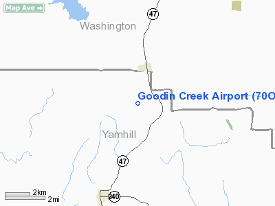
Location & QuickFacts
| FAA Information Effective: | 2008-09-25 |
| Airport Identifier: | 70OR |
| Airport Status: | Operational |
| Longitude/Latitude: | 123-08-56.3850W/45-24-34.4120N
-123.148996/45.409559 (Estimated) |
| Elevation: | 245 ft / 74.68 m (Estimated) |
| Land: | 20 acres |
| From nearest city: | 1 nautical miles SW of Gaston, OR |
| Location: | Yamhill County, OR |
| Magnetic Variation: | 19E (1990) |
Owner & Manager
| Ownership: | Privately owned |
| Owner: | Robert K & Marlyne K Cook |
| Address: | 3050 Goodin Creek Road
Gaston, OR 97119 |
| Phone number: | 503-662-3721 |
| Manager: | Robert K Cook |
| Address: | 3050 Goodin Creek Road
Gaston, OR 97119 |
| Phone number: | 503-662-3721 |
Airport Operations and Facilities
| Airport Use: | Private |
| Wind indicator: | Yes |
| Segmented Circle: | No |
| Control Tower: | No |
| Sectional chart: | Seattle |
| Region: | ANM - Northwest Mountain |
| Boundary ARTCC: | ZSE - Seattle |
| Tie-in FSS: | MMV - Mc Minnville |
| FSS on Airport: | No |
| FSS Toll Free: | 1-800-WX-BRIEF |
Runway Information
Runway 01/19
| Dimension: | 1600 x 75 ft / 487.7 x 22.9 m |
| Surface: | TURF, |
| |
Runway 01 |
Runway 19 |
| Traffic Pattern: | Left | Right |
| Obstruction: | 30 ft pline, 50.0 ft from runway |
30-1 APCH SLOPE TERRAIN 1000 FT. |
|
Radio Navigation Aids
| ID |
Type |
Name |
Ch |
Freq |
Var |
Dist |
| PND | NDB | Banks | | 356.00 | 21E | 14.0 nm |
| LBH | NDB | Laker | | 332.00 | 20E | 30.0 nm |
| LSO | NDB | Kelso | | 256.00 | 21E | 45.9 nm |
| PEN | NDB | Karpen | | 201.00 | 20E | 47.6 nm |
| LWG | NDB | Lewisburg | | 225.00 | 18E | 48.1 nm |
| CBU | TACAN | Columbia | 029X | | 20E | 25.1 nm |
| UBG | VOR/DME | Newberg | 121X | 117.40 | 21E | 8.0 nm |
| PDX | VOR/DME | Portland | 055X | 111.80 | 20E | 25.4 nm |
| BTG | VORTAC | Battle Ground | 113X | 116.60 | 21E | 31.0 nm |
| HIO | VOT | Portland-hillsboro | | 115.20 | | 11.5 nm |
| PDX | VOT | Portland Intl | | 111.00 | | 25.7 nm |
Remarks
- AIRCRAFT DEPART ON RY 01 & LAND ON RY 19.
Images and information placed above are from
http://www.airport-data.com/airport/70OR/
We thank them for the data!
| General Info
|
| Country |
United States
|
| State |
OREGON
|
| FAA ID |
70OR
|
| Latitude |
45-24-34.412N
|
| Longitude |
123-08-56.385W
|
| Elevation |
245 feet
|
| Near City |
GASTON
|
We don't guarantee the information is fresh and accurate. The data may
be wrong or outdated.
For more up-to-date information please refer to other sources.
|
|


