 |
|
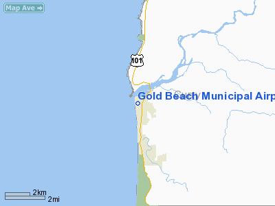
| Bold Beach Municipal Airport |
| IATA: GOL – ICAO: FAA: 4S1 |
| Summary |
| Airport type |
Public |
| Operator |
Port of Gold Beach |
| Location |
Gold Beach, Oregon |
| Elevation AMSL |
18 ft / 5 m |
| Coordinates |
42°24′48.4000″N 124°25′27.3870″W / 42.413444°N 124.42427417°W / 42.413444; -124.42427417Coordinates: 42°24′48.4000″N 124°25′27.3870″W / 42.413444°N 124.42427417°W / 42.413444; -124.42427417 |
| Runways |
| Direction |
Length |
Surface |
| ft |
m |
| 16/34 |
3200 |
975 |
Asphalt |
Gold Beach Municipal Airport (FAA LID: 4S1), is a public airport located in Gold Beach in Curry County, Oregon, USA.
The above content comes from Wikipedia and is published under free licenses – click here to read more.
Location & QuickFacts
| FAA Information Effective: | 2008-09-25 |
| Airport Identifier: | 4S1 |
| Airport Status: | Operational |
| Longitude/Latitude: | 124-25-29.7204W/42-24-55.0717N
-124.424922/42.415298 (Estimated) |
| Elevation: | 18 ft / 5.49 m (Estimated) |
| Land: | 48 acres |
| From nearest city: | 0 nautical miles W of Gold Beach, OR |
| Location: | Curry County, OR |
| Magnetic Variation: | 18E (1985) |
Owner & Manager
| Ownership: | Publicly owned |
| Owner: | Port Of Gold Beach |
| Address: | Box 1126
Gold Beach, OR 97444 |
| Phone number: | 541-247-6269 |
| Manager: | Don Flynn |
| Address: | Box 1126
Gold Beach, OR 97444 |
| Phone number: | 541-247-6269 |
Airport Operations and Facilities
| Airport Use: | Open to public |
| Wind indicator: | Yes |
| Segmented Circle: | Yes |
| Control Tower: | No |
| Lighting Schedule: | DUSK-DAWN
ACTVT MIRL RY 16/34 & REIL RYS 16 & 34 - CTAF. |
| Beacon Color: | Clear-Green (lighted land airport) |
| Landing fee charge: | No |
| Sectional chart: | Klamath Falls |
| Region: | ANM - Northwest Mountain |
| Boundary ARTCC: | ZSE - Seattle |
| Tie-in FSS: | MMV - Mc Minnville |
| FSS on Airport: | No |
| FSS Toll Free: | 1-800-WX-BRIEF |
| NOTAMs Facility: | MMV (NOTAM-d service avaliable) |
| Federal Agreements: | NGY |
Airport Communications
| CTAF: | 122.800 |
| Unicom: | 122.800
UNICOM MONITORED (0800-1700). |
Airport Services
| Fuel available: | 100LLA |
| Bottled Oxygen: | NONE |
Runway Information
Runway 16/34
| Dimension: | 3237 x 75 ft / 986.6 x 22.9 m |
| Surface: | ASPH, Good Condition |
| Weight Limit: | Single wheel: 12500 lbs. |
| Edge Lights: | Medium |
| |
Runway 16 |
Runway 34 |
| Longitude: | 124-25-31.4618W | 124-25-27.9789W |
| Latitude: | 42-25-11.0054N | 42-24-39.1379N |
| Elevation: | 20.00 ft | 20.00 ft |
| Traffic Pattern: | Right | Left |
| Markings: | Basic, Good Condition | Basic, Good Condition |
| Displaced threshold: | 90.00 ft | 0.00 ft |
| Runway End Identifier: | Yes | Yes |
| Obstruction: | 15 ft road, 220.0 ft from runway, 125 ft left of centerline, 1:1 slope to clear
APCH RATIO 20:1 TO DSPLCD THLD; TREES AT 4300 FT APCH RATIO 20:1. | 10 ft road, 300.0 ft from runway, 10:1 slope to clear |
|
Radio Navigation Aids
| ID |
Type |
Name |
Ch |
Freq |
Var |
Dist |
| CEC | VORTAC | Crescent City | 027X | 109.00 | 19E | 39.1 nm |
Remarks
- BE ALERT: BIRDS ON AND IN THE VICINITY OF ARPT.
Images and information placed above are from
http://www.airport-data.com/airport/4S1/
We thank them for the data!
| General Info
|
| Country |
United States
|
| State |
OREGON
|
| FAA ID |
4S1
|
| Latitude |
42-24-48.400N
|
| Longitude |
124-25-27.387W
|
| Elevation |
16 feet
|
| Near City |
GOLD BEACH
|
We don't guarantee the information is fresh and accurate. The data may
be wrong or outdated.
For more up-to-date information please refer to other sources.
|
|


