 |
|
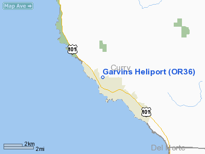
Location & QuickFacts
| FAA Information Effective: | 2008-09-25 |
| Airport Identifier: | OR36 |
| Airport Status: | Operational |
| Longitude/Latitude: | 124-17-44.3370W/42-04-01.4010N
-124.295649/42.067056 (Estimated) |
| Elevation: | 250 ft / 76.20 m (Estimated) |
| Land: | 5 acres |
| From nearest city: | 0 nautical miles N of Brookings, OR |
| Location: | Curry County, OR |
| Magnetic Variation: | 18E (1985) |
Owner & Manager
| Ownership: | Privately owned |
| Owner: | Vern R Garvin |
| Address: | Box 1220
Brookings, OR 97415 |
| Phone number: | 503-469-2241 |
| Manager: | Vern R Garvin |
| Address: | Box 1220
Brookings, OR 97415 |
Airport Operations and Facilities
| Airport Use: | Private |
| Wind indicator: | No |
| Segmented Circle: | No |
| Control Tower: | No |
| Landing fee charge: | No |
| Sectional chart: | Klamath Falls |
| Region: | ANM - Northwest Mountain |
| Boundary ARTCC: | ZSE - Seattle |
| Tie-in FSS: | MMV - Mc Minnville |
| FSS on Airport: | No |
| FSS Toll Free: | 1-800-WX-BRIEF |
Airport Services
| Airframe Repair: | NONE |
| Power Plant Repair: | NONE |
Runway Information
Helipad H1
| Dimension: | 100 x 100 ft / 30.5 x 30.5 m |
| Surface: | TURF, |
| |
Runway H1 |
Runway |
| Elevation: | 250.00 ft | 0.00 ft |
| Traffic Pattern: | Left | Left |
|
Radio Navigation Aids
| ID |
Type |
Name |
Ch |
Freq |
Var |
Dist |
| CEC | VORTAC | Crescent City | 027X | 109.00 | 19E | 17.5 nm |
Images and information placed above are from
http://www.airport-data.com/airport/OR36/
We thank them for the data!
| General Info
|
| Country |
United States
|
| State |
OREGON
|
| FAA ID |
OR36
|
| Latitude |
42-04-01.401N
|
| Longitude |
124-17-44.337W
|
| Elevation |
250 feet
|
| Near City |
BROOKINGS
|
We don't guarantee the information is fresh and accurate. The data may
be wrong or outdated.
For more up-to-date information please refer to other sources.
|
|


