 |
|
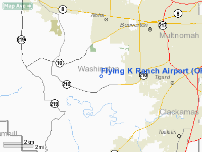
Location & QuickFacts
| FAA Information Effective: | 2008-09-25 |
| Airport Identifier: | OR00 |
| Airport Status: | Operational |
| Longitude/Latitude: | 122-52-48.0000W/45-26-04.3000N
-122.880000/45.434528 (Estimated) |
| Elevation: | 350 ft / 106.68 m (Estimated) |
| Land: | 200 acres |
| From nearest city: | 4 nautical miles NE of Beaverton, OR |
| Location: | Washington County, OR |
| Magnetic Variation: | 19E (1995) |
Owner & Manager
| Ownership: | Privately owned |
| Owner: | John Kobbe |
| Address: | 11795 Kobbe Drive
Beaverton, OR 97007 |
| Phone number: | 503-649-3381
OR CALL 503-628-0526. |
| Manager: | Ed Bartholemy |
| Address: | 18485 Sw Scholls Ferry Road
Beaverton, OR 97007 |
| Phone number: | 503-628-0526 |
Airport Operations and Facilities
| Airport Use: | Private |
| Wind indicator: | Yes |
| Segmented Circle: | No |
| Control Tower: | No |
| Sectional chart: | Seattle |
| Region: | ANM - Northwest Mountain |
| Boundary ARTCC: | ZSE - Seattle |
| Tie-in FSS: | MMV - Mc Minnville |
| FSS Toll Free: | 1-800-WX-BRIEF |
Runway Information
Runway 07/25
| Dimension: | 1700 x 20 ft / 518.2 x 6.1 m |
| Surface: | TURF-GRVL, |
| |
Runway 07 |
Runway 25 |
| Traffic Pattern: | Left | Left |
| Obstruction: | | 20 ft bldg, 1000.0 ft from runway |
|
Radio Navigation Aids
| ID |
Type |
Name |
Ch |
Freq |
Var |
Dist |
| PND | NDB | Banks | | 356.00 | 21E | 13.7 nm |
| LBH | NDB | Laker | | 332.00 | 20E | 18.7 nm |
| LSO | NDB | Kelso | | 256.00 | 21E | 43.4 nm |
| CBU | TACAN | Columbia | 029X | | 20E | 14.6 nm |
| UBG | VOR/DME | Newberg | 121X | 117.40 | 21E | 6.4 nm |
| PDX | VOR/DME | Portland | 055X | 111.80 | 20E | 15.0 nm |
| BTG | VORTAC | Battle Ground | 113X | 116.60 | 21E | 22.4 nm |
| HIO | VOT | Portland-hillsboro | | 115.20 | | 7.0 nm |
| PDX | VOT | Portland Intl | | 111.00 | | 15.3 nm |
Remarks
- RY 07/25 SOFT AFTER HEAVY RAIN.
- TREES S OF CNTRLN RY 07/25.
Images and information placed above are from
http://www.airport-data.com/airport/OR00/
We thank them for the data!
| General Info
|
| Country |
United States
|
| State |
OREGON
|
| FAA ID |
OR00
|
| Latitude |
45-26-04.300N
|
| Longitude |
122-52-48.000W
|
| Elevation |
350 feet
|
| Near City |
BEAVERTON
|
We don't guarantee the information is fresh and accurate. The data may
be wrong or outdated.
For more up-to-date information please refer to other sources.
|
|


