 |
|
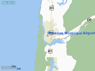
| Florence Municipal Airport |
| IATA: none – ICAO: FAA: 6S2 |
| Summary |
| Airport type |
Public |
| Operator |
City of Florence |
| Location |
Florence, Oregon |
| Elevation AMSL |
51 ft / 15.5 m |
| Coordinates |
43°58′58.1400″N 124°06′40.9300″W / 43.9828167°N 124.1113694°W / 43.9828167; -124.1113694Coordinates: 43°58′58.1400″N 124°06′40.9300″W / 43.9828167°N 124.1113694°W / 43.9828167; -124.1113694 |
| Website |
See External Links |
| Runways |
| Direction |
Length |
Surface |
| ft |
m |
| 15/33 |
2916 |
889 |
Asphalt |
Florence Municipal Airport (FAA LID: 6S2), is a public airport located in the city of Florence in Lane County, Oregon, USA.
The above content comes from Wikipedia and is published under free licenses – click here to read more.
Location & QuickFacts
| FAA Information Effective: | 2008-09-25 |
| Airport Identifier: | 6S2 |
| Airport Status: | Operational |
| Longitude/Latitude: | 124-06-40.9275W/43-58-57.7181N
-124.111369/43.982699 (Estimated) |
| Elevation: | 51 ft / 15.54 m (Surveyed) |
| Land: | 167 acres |
| From nearest city: | 1 nautical miles N of Florence, OR |
| Location: | Lane County, OR |
| Magnetic Variation: | 19E (1985) |
Owner & Manager
| Ownership: | Publicly owned |
| Owner: | City Of Florence |
| Address: | 250 Highway 101
Florence, OR 97439 |
| Phone number: | 541-997-3437 |
| Manager: | Rennie Kirk |
| Address: | 2001 Airport Way
Florence, OR 97439 |
| Phone number: | 541-997-8069 |
Airport Operations and Facilities
| Airport Use: | Open to public |
| Wind indicator: | Yes |
| Segmented Circle: | Yes
NSTD - 30 FT DIAM. |
| Control Tower: | No |
| Lighting Schedule: | DUSK-DAWN
ACTVT MIRL RY 15/33 - CTAF. PAPI RY 33 OPR 24 HRS. |
| Beacon Color: | Clear-Green (lighted land airport) |
| Landing fee charge: | No |
| Sectional chart: | Klamath Falls |
| Region: | ANM - Northwest Mountain |
| Boundary ARTCC: | ZSE - Seattle |
| Tie-in FSS: | MMV - Mc Minnville |
| FSS on Airport: | No |
| FSS Toll Free: | 1-800-WX-BRIEF |
| NOTAMs Facility: | MMV (NOTAM-d service avaliable) |
| Federal Agreements: | NGY |
Airport Communications
| CTAF: | 122.800 |
| Unicom: | 122.800 |
Airport Services
| Fuel available: | 100LLA |
| Bottled Oxygen: | NONE |
| Bulk Oxygen: | NONE |
Runway Information
Runway 15/33
| Dimension: | 2916 x 60 ft / 888.8 x 18.3 m |
| Surface: | ASPH, Good Condition |
| Weight Limit: | Single wheel: 12500 lbs. |
| Edge Lights: | Medium |
| |
Runway 15 |
Runway 33 |
| Longitude: | 124-06-45.3662W | 124-06-36.4887W |
| Latitude: | 43-59-11.7538N | 43-58-43.6823N |
| Elevation: | 51.00 ft | 40.00 ft |
| Alignment: | 127 | 127 |
| Traffic Pattern: | Right | Left |
| Markings: | Basic, Good Condition | Basic, Good Condition |
| Crossing Height: | 0.00 ft | 40.00 ft |
| VASI: | | 2-light PAPI on left side |
| Visual Glide Angle: | 0.00° | 3.00° |
| Obstruction: | 32 ft , 1150.0 ft from runway, 29:1 slope to clear | 26 ft trees, 840.0 ft from runway, 100 ft right of centerline, 25:1 slope to clear |
|
Radio Navigation Aids
| ID |
Type |
Name |
Ch |
Freq |
Var |
Dist |
| EU | NDB | Frakk | | 260.00 | 19E | 40.9 nm |
| CVO | VOR/DME | Corvallis | 101X | 115.40 | 18E | 47.0 nm |
| OTH | VORTAC | North Bend | 058X | 112.10 | 18E | 34.2 nm |
| ONP | VORTAC | Newport | 118X | 117.10 | 19E | 35.7 nm |
| EUG | VORTAC | Eugene | 076X | 112.90 | 20E | 39.3 nm |
Remarks
- BIRDS, DEER & WILDLIFE ON & INVOF ARPT.
- PUB USE OBJECTIONABLE IF RQRD APCH SFC IS NOT PROVIDED. FAR PART 77 SPECIFIES 20-1 APCH SFC FOR UTILITY RWY.
Images and information placed above are from
http://www.airport-data.com/airport/6S2/
We thank them for the data!
| General Info
|
| Country |
United States
|
| State |
OREGON
|
| FAA ID |
6S2
|
| Latitude |
43-58-44.436N
|
| Longitude |
124-06-34.427W
|
| Elevation |
46 feet
|
| Near City |
FLORENCE
|
We don't guarantee the information is fresh and accurate. The data may
be wrong or outdated.
For more up-to-date information please refer to other sources.
|
|


