 |
|
Location & QuickFacts
| FAA Information Effective: | 2008-09-25 |
| Airport Identifier: | OR26 |
| Airport Status: | Operational |
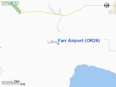
| Longitude/Latitude: | 120-29-01.8580W/42-07-39.5790N
-120.483849/42.127661 (Estimated) |
| Elevation: | 4775 ft / 1455.42 m (Estimated) |
| Land: | 80 acres |
| From nearest city: | 7 nautical miles SW of Lakeview, OR |
| Location: | Lake County, OR |
| Magnetic Variation: | 17E (1985) |
Owner & Manager
| Ownership: | Privately owned |
| Owner: | Samuel R. Farr |
| Address: | Hc 60 Box 4710
Lakeview, OR 97630 |
| Phone number: | 503-947-4586 |
| Manager: | Samuel R. Farr |
| Address: | Hc 60 Box A4710
Lakeview, OR 97630 |
| Phone number: | 503-947-4586 |
Airport Operations and Facilities
| Airport Use: | Private
PERSONAL USE. |
| Segmented Circle: | No |
| Control Tower: | No |
| Sectional chart: | Klamath Falls |
| Region: | ANM - Northwest Mountain |
| Boundary ARTCC: | ZSE - Seattle |
| Tie-in FSS: | MMV - Mc Minnville |
| FSS Toll Free: | 1-800-WX-BRIEF |
Runway Information
Runway 17/35
| Dimension: | 2800 x 40 ft / 853.4 x 12.2 m |
| Surface: | TURF, |
| |
Runway 17 |
Runway 35 |
| Traffic Pattern: | Left | Left |
|
Radio Navigation Aids
| ID |
Type |
Name |
Ch |
Freq |
Var |
Dist |
| ARU | NDB | Alturas | | 215.00 | 18E | 39.6 nm |
| LKV | VORTAC | Lakeview | 57X | 112.00 | 19E | 22.0 nm |
Remarks
Images and information placed above are from
http://www.airport-data.com/airport/OR26/
We thank them for the data!
| General Info
|
| Country |
United States
|
| State |
OREGON
|
| FAA ID |
OR26
|
| Latitude |
42-07-39.579N
|
| Longitude |
120-29-01.858W
|
| Elevation |
4775 feet
|
| Near City |
LAKEVIEW
|
We don't guarantee the information is fresh and accurate. The data may
be wrong or outdated.
For more up-to-date information please refer to other sources.
|
|


