 |
|
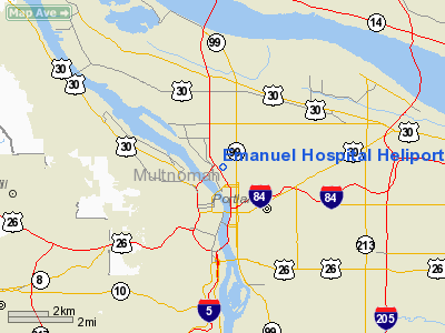
Emanuel Hospital Heliport |
Location & QuickFacts
| FAA Information Effective: | 2008-09-25 |
| Airport Identifier: | 7OR5 |
| Airport Status: | Operational |
| Longitude/Latitude: | 122-40-12.3460W/45-32-35.4240N
-122.670096/45.543173 (Estimated) |
| Elevation: | 160 ft / 48.77 m (Estimated) |
| Land: | 52 acres |
| From nearest city: | 0 nautical miles N of Portland, OR |
| Location: | Multnomah County, OR |
| Magnetic Variation: | 19E (1985) |
Owner & Manager
| Ownership: | Privately owned |
| Owner: | Emanuel Hospital |
| Address: | 2801 N Gantenbein Ave
Portland, OR 97227 |
| Phone number: | 503-280-5433 |
| Manager: | David Long Dir |
| Address: | 2801 N Gantenbein Ave
Portland, OR 97227 |
| Phone number: | 503-280-4006 |
Airport Operations and Facilities
| Airport Use: | Private
MEDICAL USE. |
| Wind indicator: | Yes |
| Segmented Circle: | No |
| Control Tower: | No |
| Lighting Schedule: | DUSK-DAWN |
| Landing fee charge: | No |
| Sectional chart: | Seattle |
| Region: | ANM - Northwest Mountain |
| Boundary ARTCC: | ZSE - Seattle |
| Tie-in FSS: | MMV - Mc Minnville |
| FSS on Airport: | No |
| FSS Toll Free: | 1-800-WX-BRIEF |
Airport Communications
Runway Information
Helipad H1
| Dimension: | 60 x 60 ft / 18.3 x 18.3 m |
| Surface: | CONC,
ROOFTOP.
GROUND LEVEL. |
| |
Runway H1 |
Runway |
| Traffic Pattern: | Left | Left |
|
Helipad H2
| Dimension: | 50 x 50 ft / 15.2 x 15.2 m |
| Surface: | CONC,
ROOFTOP.
GROUND LEVEL. |
| |
Runway H2 |
Runway |
| Traffic Pattern: | Left | Left |
|
Radio Navigation Aids
| ID |
Type |
Name |
Ch |
Freq |
Var |
Dist |
| LBH | NDB | Laker | | 332.00 | 20E | 8.7 nm |
| PND | NDB | Banks | | 356.00 | 21E | 16.6 nm |
| LSO | NDB | Kelso | | 256.00 | 21E | 38.2 nm |
| CBU | TACAN | Columbia | 029X | | 20E | 3.7 nm |
| PDX | VOR/DME | Portland | 055X | 111.80 | 20E | 4.1 nm |
| UBG | VOR/DME | Newberg | 121X | 117.40 | 21E | 17.3 nm |
| BTG | VORTAC | Battle Ground | 113X | 116.60 | 21E | 12.7 nm |
| PDX | VOT | Portland Intl | | 111.00 | | 4.4 nm |
| HIO | VOT | Portland-hillsboro | | 115.20 | | 11.7 nm |
Images and information placed above are from
http://www.airport-data.com/airport/7OR5/
We thank them for the data!
| General Info
|
| Country |
United States
|
| State |
OREGON
|
| FAA ID |
7OR5
|
| Latitude |
45-32-35.424N
|
| Longitude |
122-40-12.346W
|
| Elevation |
160 feet
|
| Near City |
PORTLAND
|
We don't guarantee the information is fresh and accurate. The data may
be wrong or outdated.
For more up-to-date information please refer to other sources.
|
|


