 |
|
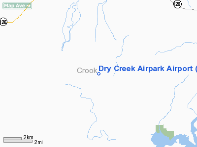
Dry Creek Airpark Airport |
Location & QuickFacts
| FAA Information Effective: | 2008-09-25 |
| Airport Identifier: | OG21 |
| Airport Status: | Operational |
| Longitude/Latitude: | 120-49-23.1000W/44-11-42.5000N
-120.823083/44.195139 (Estimated) |
| Elevation: | 3625 ft / 1104.90 m (Estimated) |
| Land: | 147 acres |
| From nearest city: | 8 nautical miles S of Prineville, OR |
| Location: | Crook County, OR |
| Magnetic Variation: | 18E (1995) |
Owner & Manager
| Ownership: | Privately owned |
| Owner: | Dry Creek Airpark, Llc |
| Address: | Po Box 598
Prineville, OR 97754 |
| Phone number: | 541-416-8956 |
| Manager: | Brad Lefler |
| Address: | 2552 Ne 3rd St
Prineville, OR 97754 |
| Phone number: | 541-416-8956 |
Airport Operations and Facilities
| Airport Use: | Private |
| Wind indicator: | Yes |
| Segmented Circle: | No |
| Control Tower: | No |
| Lighting Schedule: | RDO-CTL
ACTVT HIRL RY 07/25 - 123.3. |
| Sectional chart: | Klamath Falls |
| Region: | ANM - Northwest Mountain |
| Boundary ARTCC: | ZSE - Seattle |
| Tie-in FSS: | MMV - Mc Minnville |
| FSS Toll Free: | 1-800-WX-BRIEF |
Runway Information
Runway 07/25
| Dimension: | 3000 x 35 ft / 914.4 x 10.7 m |
| Surface: | ASPH, Good Condition |
| Edge Lights: | High |
| |
Runway 07 |
Runway 25 |
| Traffic Pattern: | Left | Left |
| Markings: | Nonstandard, | Nonstandard, |
|
Radio Navigation Aids
| ID |
Type |
Name |
Ch |
Freq |
Var |
Dist |
| RD | NDB | Bodey | | 411.00 | 18E | 10.8 nm |
| DSD | VORTAC | Deschutes | 123X | 117.60 | 18E | 21.0 nm |
Images and information placed above are from
http://www.airport-data.com/airport/OG21/
We thank them for the data!
| General Info
|
| Country |
United States
|
| State |
OREGON
|
| FAA ID |
OG21
|
| Latitude |
44-11-42.500N
|
| Longitude |
120-49-23.100W
|
| Elevation |
3625 feet
|
| Near City |
PRINEVILLE
|
We don't guarantee the information is fresh and accurate. The data may
be wrong or outdated.
For more up-to-date information please refer to other sources.
|
|


