 |
|
Location & QuickFacts
| FAA Information Effective: | 2008-09-25 |
| Airport Identifier: | 46OR |
| Airport Status: | Operational |
| Longitude/Latitude: | 118-48-31.9510W/45-38-33.4690N
-118.808875/45.642630 (Estimated) |
| Elevation: | 1275 ft / 388.62 m (Estimated) |
| Land: | 45 acres |
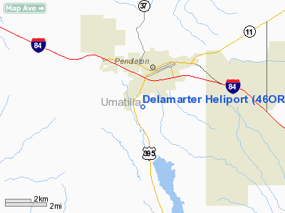
| From nearest city: | 3 nautical miles SW of Pendleton, OR |
| Location: | Umatilla County, OR |
| Magnetic Variation: | 19E (1985) |
Owner & Manager
| Ownership: | Privately owned |
| Owner: | Harold G. Delamarter |
| Address: | Rt 1, Box 35
Pendleton, OR 97801 |
| Phone number: | 503-276-7157 |
| Address: |
|
Airport Operations and Facilities
| Airport Use: | Private |
| Wind indicator: | No |
| Segmented Circle: | No |
| Control Tower: | No |
| Landing fee charge: | No |
| Sectional chart: | Seattle |
| Region: | ANM - Northwest Mountain |
| Boundary ARTCC: | ZSE - Seattle |
| Tie-in FSS: | MMV - Mc Minnville |
| FSS on Airport: | No |
| FSS Toll Free: | 1-800-WX-BRIEF |
Runway Information
Helipad H1
| Dimension: | 250 x 70 ft / 76.2 x 21.3 m |
| Surface: | GRAVEL, |
| |
Runway H1 |
Runway |
| Traffic Pattern: | Left | Left |
|
Radio Navigation Aids
| ID |
Type |
Name |
Ch |
Freq |
Var |
Dist |
| PD | NDB | Foris | | 230.00 | 20E | 4.6 nm |
| LGD | NDB | La Grande | | 296.00 | 17E | 40.0 nm |
| ALW | VOR/DME | Walla Walla | 111X | 116.40 | 20E | 34.4 nm |
| PSC | VOR/DME | Pasco | 021X | 108.40 | 20E | 39.4 nm |
| PDT | VORTAC | Pendleton | 094X | 114.70 | 20E | 6.4 nm |
Remarks
- FOR HELIPORT ATTENDANT CALL 503-276-7157.
Images and information placed above are from
http://www.airport-data.com/airport/46OR/
We thank them for the data!
| General Info
|
| Country |
United States
|
| State |
OREGON
|
| FAA ID |
46OR
|
| Latitude |
45-38-33.469N
|
| Longitude |
118-48-31.951W
|
| Elevation |
1275 feet
|
| Near City |
PENDLETON
|
We don't guarantee the information is fresh and accurate. The data may
be wrong or outdated.
For more up-to-date information please refer to other sources.
|
|


