 |
|
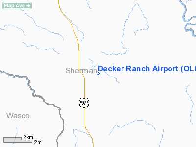
Location & QuickFacts
| FAA Information Effective: | 2008-09-25 |
| Airport Identifier: | OL04 |
| Airport Status: | Operational |
| Longitude/Latitude: | 120-40-04.1690W/45-09-59.4540N
-120.667825/45.166515 (Estimated) |
| Elevation: | 2621 ft / 798.88 m (Estimated) |
| Land: | 0 acres |
| From nearest city: | 3 nautical miles SE of Kent, OR |
| Location: | Sherman County, OR |
| Magnetic Variation: | 19E (1985) |
Owner & Manager
| Ownership: | Privately owned |
| Owner: | Art Decker |
| Address: |
Kent, OR 97033 |
| Phone number: | 503-333-2205 |
| Address: |
|
Airport Operations and Facilities
| Airport Use: | Private |
| Wind indicator: | Yes |
| Segmented Circle: | No |
| Control Tower: | No |
| Landing fee charge: | No |
| Sectional chart: | Seattle |
| Region: | ANM - Northwest Mountain |
| Boundary ARTCC: | ZSE - Seattle |
| Tie-in FSS: | MMV - Mc Minnville |
| FSS on Airport: | No |
| FSS Toll Free: | 1-800-WX-BRIEF |
Airport Services
| Airframe Repair: | NONE |
| Power Plant Repair: | NONE |
| Bottled Oxygen: | NONE |
| Bulk Oxygen: | NONE |
Runway Information
Runway ENE/WSW
| Dimension: | 1840 x 70 ft / 560.8 x 21.3 m |
| Surface: | DIRT, |
| |
Runway ENE |
Runway WSW |
| Traffic Pattern: | Left | Left |
| Runway End Identifier: | No | No |
| Centerline Lights: | No | No |
| Touchdown Lights: | No | No |
|
Radio Navigation Aids
| ID |
Type |
Name |
Ch |
Freq |
Var |
Dist |
| LTJ | VOR/DME | Klickitat | 070X | 112.30 | 21E | 37.6 nm |
Remarks
Images and information placed above are from
http://www.airport-data.com/airport/OL04/
We thank them for the data!
| General Info
|
| Country |
United States
|
| State |
OREGON
|
| FAA ID |
OL04
|
| Latitude |
45-09-59.454N
|
| Longitude |
120-40-04.169W
|
| Elevation |
2621 feet
|
| Near City |
KENT
|
We don't guarantee the information is fresh and accurate. The data may
be wrong or outdated.
For more up-to-date information please refer to other sources.
|
|


