 |
|
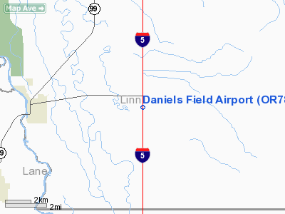
Location & QuickFacts
| FAA Information Effective: | 2008-09-25 |
| Airport Identifier: | OR78 |
| Airport Status: | Operational |
| Longitude/Latitude: | 123-03-39.3190W/44-16-19.4460N
-123.060922/44.272068 (Estimated) |
| Elevation: | 320 ft / 97.54 m (Estimated) |
| Land: | 55 acres |
| From nearest city: | 5 nautical miles E of Harrisburg, OR |
| Location: | Linn County, OR |
| Magnetic Variation: | 19E (1985) |
Owner & Manager
| Ownership: | Privately owned |
| Owner: | Wac Corp Inc. |
| Address: | 520 Conger St
Eugene, OR 97402 |
| Phone number: | 503-342-5169 |
| Manager: | Gordon Wilkinson |
| Address: |
Eugene, OR 97403 |
| Phone number: | 503-995-8600
ADD'L PHONE 503-995-8601. |
Airport Operations and Facilities
| Airport Use: | Private |
| Wind indicator: | Yes |
| Segmented Circle: | No |
| Control Tower: | No |
| Landing fee charge: | No |
| Sectional chart: | Klamath Falls |
| Region: | ANM - Northwest Mountain |
| Boundary ARTCC: | ZSE - Seattle |
| Tie-in FSS: | MMV - Mc Minnville |
| FSS on Airport: | No |
| FSS Toll Free: | 1-800-WX-BRIEF |
Airport Services
| Airframe Repair: | NONE |
| Power Plant Repair: | NONE |
Runway Information
Runway 16/34
| Dimension: | 3000 x 40 ft / 914.4 x 12.2 m
<850' OVRN NORTH END & 470' OVRN SOUTH END RWY 16/34. |
| Surface: | TURF-GRVL, |
| |
Runway 16 |
Runway 34 |
| Traffic Pattern: | Right | Right |
|
Radio Navigation Aids
| ID |
Type |
Name |
Ch |
Freq |
Var |
Dist |
| EU | NDB | Frakk | | 260.00 | 19E | 7.7 nm |
| LWG | NDB | Lewisburg | | 225.00 | 18E | 22.4 nm |
| CVO | VOR/DME | Corvallis | 101X | 115.40 | 18E | 16.9 nm |
| EUG | VORTAC | Eugene | 076X | 112.90 | 20E | 11.5 nm |
| ONP | VORTAC | Newport | 118X | 117.10 | 19E | 46.6 nm |
Remarks
- NO OBJ PROVIDED RWY 16 THR IS DSPLCD TO PROVIDE 15' HWY CLNC USING 40-1 SLOPE.
Images and information placed above are from
http://www.airport-data.com/airport/OR78/
We thank them for the data!
| General Info
|
| Country |
United States
|
| State |
OREGON
|
| FAA ID |
OR78
|
| Latitude |
44-16-19.446N
|
| Longitude |
123-03-39.319W
|
| Elevation |
320 feet
|
| Near City |
HARRISBURG
|
We don't guarantee the information is fresh and accurate. The data may
be wrong or outdated.
For more up-to-date information please refer to other sources.
|
|


