 |
|
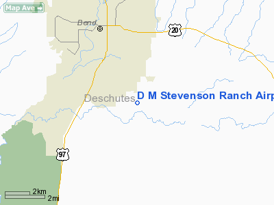
D M Stevenson Ranch Airport |
Location & QuickFacts
| FAA Information Effective: | 2008-09-25 |
| Airport Identifier: | OR30 |
| Airport Status: | Operational |
| Longitude/Latitude: | 121-16-19.1040W/44-00-11.4220N
-121.271973/44.003173 (Estimated) |
| Elevation: | 3800 ft / 1158.24 m (Estimated) |
| Land: | 0 acres |
| From nearest city: | 5 nautical miles SE of Bend, OR |
| Location: | Deschutes County, OR |
| Magnetic Variation: | 18E (1985) |
Owner & Manager
| Ownership: | Privately owned |
| Owner: | D M Stevenson Ranch |
| Address: | 21085 Knott Road
Bend, OR 97702 |
| Phone number: | 503-386-2200 |
| Manager: | Tom Stevenson |
| Address: | 1108 E Marina Way
Hood River, OR 97031 |
| Phone number: | 503-386-2200 |
Airport Operations and Facilities
| Airport Use: | Private |
| Wind indicator: | No |
| Segmented Circle: | No |
| Control Tower: | No |
| Landing fee charge: | No |
| Sectional chart: | Klamath Falls |
| Region: | ANM - Northwest Mountain |
| Boundary ARTCC: | ZSE - Seattle |
| Tie-in FSS: | MMV - Mc Minnville |
| FSS on Airport: | No |
| FSS Toll Free: | 1-800-WX-BRIEF |
Runway Information
Runway 16/34
| Dimension: | 2100 x 60 ft / 640.1 x 18.3 m |
| Surface: | TURF, |
| |
Runway 16 |
Runway 34 |
| Traffic Pattern: | Left | Left |
|
Radio Navigation Aids
| ID |
Type |
Name |
Ch |
Freq |
Var |
Dist |
| RD | NDB | Bodey | | 411.00 | 18E | 21.3 nm |
| DSD | VORTAC | Deschutes | 123X | 117.60 | 18E | 15.1 nm |
Images and information placed above are from
http://www.airport-data.com/airport/OR30/
We thank them for the data!
| General Info
|
| Country |
United States
|
| State |
OREGON
|
| FAA ID |
OR30
|
| Latitude |
44-00-11.422N
|
| Longitude |
121-16-19.104W
|
| Elevation |
3800 feet
|
| Near City |
BEND
|
We don't guarantee the information is fresh and accurate. The data may
be wrong or outdated.
For more up-to-date information please refer to other sources.
|
|


