 |
|
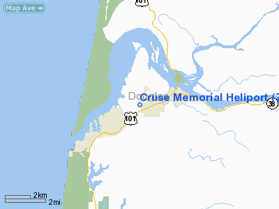
Location & QuickFacts
| FAA Information Effective: | 2008-09-25 |
| Airport Identifier: | 79OR |
| Airport Status: | Operational |
| Longitude/Latitude: | 124-08-16.4080W/43-41-41.4190N
-124.137891/43.694839 (Estimated) |
| Elevation: | 160 ft / 48.77 m (Estimated) |
| Land: | 2 acres |
| From nearest city: | 1 nautical miles NE of Reedsport, OR |
| Location: | Douglas County, OR |
| Magnetic Variation: | 19E (1985) |
Owner & Manager
| Ownership: | Publicly owned |
| Owner: | Lower Umpqua Hospital Dist. |
| Address: | 600 Ranch Road
Reedsport, OR 97467 |
| Phone number: | 503-271-2171 |
| Manager: | Sandra Reese, Ceo/cfd |
| Address: | 600 Ranch Road
Reedsport, OR 97467 |
| Phone number: | 503-271-2171 |
Airport Operations and Facilities
| Airport Use: | Private
MEDICAL USE. |
| Wind indicator: | Yes |
| Segmented Circle: | No |
| Control Tower: | No |
| Lighting Schedule: | PHONE REQ
FOR PERIMETER LGTS PHONE 503-271-2171. |
| Landing fee charge: | No |
| Sectional chart: | Seattle |
| Region: | ANM - Northwest Mountain |
| Boundary ARTCC: | ZSE - Seattle |
| Tie-in FSS: | MMV - Mc Minnville |
| FSS Toll Free: | 1-800-WX-BRIEF |
Runway Information
Helipad H1
| Dimension: | 80 x 80 ft / 24.4 x 24.4 m |
| Surface: | CONC, |
| |
Runway H1 |
Runway |
| Traffic Pattern: | Left | Left |
| Markings: | Basic, | , |
|
Radio Navigation Aids
| ID |
Type |
Name |
Ch |
Freq |
Var |
Dist |
| RBG | NDB | Roseburg | | 400.00 | 20E | 43.8 nm |
| RBG | VOR/DME | Roseburg | 019X | 108.20 | 20E | 46.1 nm |
| OTH | VORTAC | North Bend | 058X | 112.10 | 18E | 16.8 nm |
| EUG | VORTAC | Eugene | 076X | 112.90 | 20E | 47.2 nm |
Remarks
- HOSPITALAND AMBULANCE MAYBE CONTACTED ON 155.340.
Images and information placed above are from
http://www.airport-data.com/airport/79OR/
We thank them for the data!
| General Info
|
| Country |
United States
|
| State |
OREGON
|
| FAA ID |
79OR
|
| Latitude |
43-41-41.419N
|
| Longitude |
124-08-16.408W
|
| Elevation |
160 feet
|
| Near City |
REEDSPORT
|
We don't guarantee the information is fresh and accurate. The data may
be wrong or outdated.
For more up-to-date information please refer to other sources.
|
|


