 |
|
Crescent Lake State Airport |
| Crescent Lake State Airport |
| IATA: none – ICAO: - FAA: 5S2 |
| Summary |
| Airport type |
Public |
| Operator |
Oregon Department of Aviation |
| Location |
Crescent Lake, Oregon |
| Elevation AMSL |
4810 ft / 1466 m |
| Coordinates |
43°31′57.4470″N 121°57′00.1060″W / 43.53262417°N 121.95002944°W / 43.53262417; -121.95002944Coordinates: 43°31′57.4470″N 121°57′00.1060″W / 43.53262417°N 121.95002944°W / 43.53262417; -121.95002944 |
| Runways |
| Direction |
Length |
Surface |
| ft |
m |
| 13/31 |
3900 |
1189 |
asphalt |
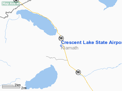
Crescent Lake State Airport (FAA LID: 5S2), is a public airport located two miles (3.2 km) north of Crescent Lake in Klamath County, Oregon, USA. On-airport camping is allowed, and boat rentals are available nearby. The airport is closed November 1 through May 1 due to snow.
The above content comes from Wikipedia and is published under free licenses – click here to read more.
Location & QuickFacts
| FAA Information Effective: | 2008-09-25 |
| Airport Identifier: | 5S2 |
| Airport Status: | Operational |
| Longitude/Latitude: | 121-57-00.1060W/43-31-57.4470N
-121.950029/43.532624 (Estimated) |
| Elevation: | 4810 ft / 1466.09 m (Estimated) |
| Land: | 45 acres |
| From nearest city: | 2 nautical miles NE of Crescent Lake, OR |
| Location: | Klamath County, OR |
| Magnetic Variation: | 18E (1985) |
Owner & Manager
| Ownership: | Publicly owned |
| Owner: | Oregon Dept. Of Aviation |
| Address: | 3040 25th St, Se
Salem, OR 97302-1125 |
| Phone number: | 503-378-4880 |
| Manager: | State Airports Manager |
| Address: | 3040 25th St, Se
Salem, OR 97302-1125 |
| Phone number: | 503-378-4880 |
Airport Operations and Facilities
| Airport Use: | Open to public |
| Wind indicator: | Yes |
| Segmented Circle: | No |
| Control Tower: | No |
| Landing fee charge: | No |
| Sectional chart: | Klamath Falls |
| Region: | ANM - Northwest Mountain |
| Traffic Pattern Alt: | 1000 ft |
| Boundary ARTCC: | ZSE - Seattle |
| Tie-in FSS: | MMV - Mc Minnville |
| FSS on Airport: | No |
| FSS Toll Free: | 1-800-WX-BRIEF |
| NOTAMs Facility: | MMV (NOTAM-d service avaliable) |
Airport Communications
Airport Services
| Airframe Repair: | NONE |
| Power Plant Repair: | NONE |
| Bottled Oxygen: | NONE |
| Bulk Oxygen: | NONE |
Runway Information
Runway 13/31
| Dimension: | 3900 x 30 ft / 1188.7 x 9.1 m
RY PAVED FULL LENGTH. 55 FT ADDED TO APPACH END RY 31 & 85 FT ADDED TO APPCH END RY 13. |
| Surface: | ASPH, Fair Condition |
| |
Runway 13 |
Runway 31 |
| Traffic Pattern: | Left | Left |
| Markings: | Basic, Fair Condition | Basic, Fair Condition |
| Displaced threshold: | 0.00 ft | 275.00 ft |
| Obstruction: | 150 ft trees, 1203.0 ft from runway, 90 ft left of centerline, 6:1 slope to clear | 55 ft trees, 200.0 ft from runway
RWY 31 APCH RATIO 8:1 TO DSPLCD THLD BASED ON 55 FT TREES 336 FT FM DSPLCD THLD ON CNTRLN.
+18 FT ROAD AT 25 FT & +55 FT TREES AT 60 FT ON CNTRLN. |
|
Radio Navigation Aids
| ID |
Type |
Name |
Ch |
Freq |
Var |
Dist |
Remarks
- ARPT CLSD NOV 1-MAY 1 DUE TO SNOW
- OWNER ADVISES CONTACT WITH STATE DEPT. OF AVIATION, 503-378-4880.
- GRAVEL OCCASIONALLY ON RUNWAY DUE TO RUN OFF
- ESTABD PRIOR TO 1959.
Images and information placed above are from
http://www.airport-data.com/airport/5S2/
We thank them for the data!
| General Info
|
| Country |
United States
|
| State |
OREGON
|
| FAA ID |
5S2
|
| Latitude |
43-31-57.447N
|
| Longitude |
121-57-00.106W
|
| Elevation |
4810 feet
|
| Near City |
CRESCENT LAKE
|
We don't guarantee the information is fresh and accurate. The data may
be wrong or outdated.
For more up-to-date information please refer to other sources.
|
|


