 |
|
Country Squire Airpark Airport |
| Country Squire Airpark |
| IATA: none – ICAO: - FAA: S48 |
| Summary |
| Airport type |
Public |
| Operator |
Private Owner |
| Location |
Sandy, Oregon |
| Elevation AMSL |
1175 ft / 358 m |
| Coordinates |
45°21′16.0000″N 122°16′05.0000″W / 45.35444°N 122.26806°W / 45.35444; -122.26806Coordinates: 45°21′16.0000″N 122°16′05.0000″W / 45.35444°N 122.26806°W / 45.35444; -122.26806 |
| Runways |
| Direction |
Length |
Surface |
| ft |
m |
| 7/25 |
3095 |
943 |
Asphalt |
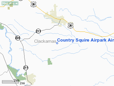
Country Squire Airpark (FAA LID: S48), is a public airport located three miles (4.8 km) south of Sandy in Clackamas County, Oregon, USA.
The above content comes from Wikipedia and is published under free licenses – click here to read more.
Location & QuickFacts
| FAA Information Effective: | 2008-09-25 |
| Airport Identifier: | S48 |
| Airport Status: | Operational |
| Longitude/Latitude: | 122-16-05.0000W/45-21-16.0000N
-122.268056/45.354444 (Estimated) |
| Elevation: | 1175 ft / 358.14 m (Estimated) |
| Land: | 120 acres |
| From nearest city: | 3 nautical miles S of Sandy, OR |
| Location: | Clackamas County, OR |
| Magnetic Variation: | 19E (1985) |
Owner & Manager
| Ownership: | Privately owned |
| Owner: | A. F. & H. C. Skipper |
| Address: | Po Box 571
Sandy, OR 97055 |
| Phone number: | 503-668-6808 |
| Manager: | Arthur F. Skipper |
| Address: | Po Box 571
Sandy, OR 97055 |
| Phone number: | 503-668-6808 |
Airport Operations and Facilities
| Airport Use: | Open to public |
| Wind indicator: | Yes |
| Segmented Circle: | No |
| Control Tower: | No |
| Landing fee charge: | Yes
OVERNIGHT TIEDOWN FEE AND LNDG FEE FOR NON BASED ACFT. |
| Sectional chart: | Seattle |
| Region: | ANM - Northwest Mountain |
| Boundary ARTCC: | ZSE - Seattle |
| Tie-in FSS: | MMV - Mc Minnville |
| FSS on Airport: | No |
| FSS Toll Free: | 1-800-WX-BRIEF |
| NOTAMs Facility: | MMV (NOTAM-d service avaliable) |
Airport Communications
Airport Services
| Bottled Oxygen: | NONE |
| Bulk Oxygen: | NONE |
Runway Information
Runway 07/25
| Dimension: | 3095 x 32 ft / 943.4 x 9.8 m |
| Surface: | ASPH, Poor Condition
RY 07/25 LOOSE GRVL ON SFC, GRASS GROWING IN CRACKS. |
| Weight Limit: | Single wheel: 7000 lbs. |
| |
Runway 07 |
Runway 25 |
| Traffic Pattern: | Left | Left |
| Markings: | None, | None, |
| Obstruction: | 60 ft trees, 1860.0 ft from runway, 27:1 slope to clear
+30 FT BLDG AT 70 FT; 120 FT R. | 65 ft tree, 676.0 ft from runway, 20 ft left of centerline, 7:1 slope to clear
+40-45 FT TREES FM RY END TO 200 FT - 90 FT L. |
|
Radio Navigation Aids
| ID |
Type |
Name |
Ch |
Freq |
Var |
Dist |
| LBH | NDB | Laker | | 332.00 | 20E | 13.9 nm |
| PND | NDB | Banks | | 356.00 | 21E | 36.7 nm |
| CBU | TACAN | Columbia | 029X | | 20E | 20.2 nm |
| PDX | VOR/DME | Portland | 055X | 111.80 | 20E | 20.2 nm |
| UBG | VOR/DME | Newberg | 121X | 117.40 | 21E | 30.0 nm |
| BTG | VORTAC | Battle Ground | 113X | 116.60 | 21E | 27.3 nm |
| PDX | VOT | Portland Intl | | 111.00 | | 20.3 nm |
| HIO | VOT | Portland-hillsboro | | 115.20 | | 30.8 nm |
Remarks
- CAUTION: WATCH FOR DEER ON AND IN VICINITY OF ARPT.
- SINK HOLE LOCATED 75 FT N OF THE AER 25.
Images and information placed above are from
http://www.airport-data.com/airport/S48/
We thank them for the data!
| General Info
|
| Country |
United States
|
| State |
OREGON
|
| FAA ID |
S48
|
| Latitude |
45-21-16.000N
|
| Longitude |
122-16-05.000W
|
| Elevation |
1175 feet
|
| Near City |
SANDY
|
We don't guarantee the information is fresh and accurate. The data may
be wrong or outdated.
For more up-to-date information please refer to other sources.
|
|


