 |
|
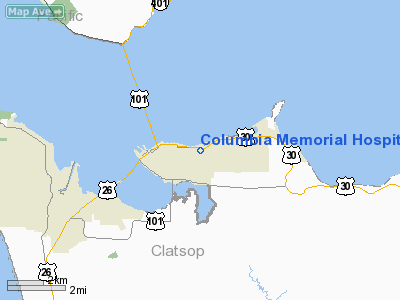
Columbia Memorial Hospital Heliport |
Location & QuickFacts
| FAA Information Effective: | 2008-09-25 |
| Airport Identifier: | OG03 |
| Airport Status: | Operational |
| Longitude/Latitude: | 123-49-04.5100W/46-11-15.3830N
-123.817919/46.187606 (Estimated) |
| Elevation: | 22 ft / 6.71 m (Estimated) |
| Land: | 0 acres |
| From nearest city: | 0 nautical miles E of Astoria, OR |
| Location: | Clatsop County, OR |
| Magnetic Variation: | 19E (1995) |
Owner & Manager
| Ownership: | Privately owned |
| Owner: | Columbia Memorial Hospital |
| Address: | 2111 Exchange Street
Astoria, OR 97103 |
| Phone number: | 503-325-4321 |
| Manager: | Mick Shepard |
| Address: | 2111 Exchange Street
Astoria, OR 97103 |
| Phone number: | 503-325-4321 |
Airport Operations and Facilities
| Airport Use: | Private
MEDICAL USE ONLY. |
| Wind indicator: | Yes |
| Segmented Circle: | No |
| Control Tower: | No |
| Lighting Schedule: | PHONE REQ
FOR PERIMETER LIGHTS CALL 503-325-4321. |
| Landing fee charge: | No |
| Sectional chart: | Seattle |
| Region: | ANM - Northwest Mountain |
| Boundary ARTCC: | ZSE - Seattle |
| Tie-in FSS: | MMV - Mc Minnville |
| FSS on Airport: | No |
| FSS Toll Free: | 1-800-WX-BRIEF |
Runway Information
Helipad H1
| Dimension: | 46 x 46 ft / 14.0 x 14.0 m |
| Surface: | CONC, Good Condition |
| |
Runway H1 |
Runway |
| Traffic Pattern: | Left | Left |
|
Radio Navigation Aids
| ID |
Type |
Name |
Ch |
Freq |
Var |
Dist |
| AST | FAN MARKER | Fort Stevens | | | 22E | 6.3 nm |
| PEN | NDB | Karpen | | 201.00 | 20E | 10.0 nm |
| LSO | NDB | Kelso | | 256.00 | 21E | 37.7 nm |
| TDO | NDB | Toledo | | 219.00 | 20E | 45.0 nm |
| PND | NDB | Banks | | 356.00 | 21E | 46.5 nm |
| AST | VOR/DME | Astoria | 087X | 114.00 | 19E | 3.0 nm |
| HQM | VORTAC | Hoquiam | 124X | 117.70 | 19E | 47.7 nm |
Images and information placed above are from
http://www.airport-data.com/airport/OG03/
We thank them for the data!
| General Info
|
| Country |
United States
|
| State |
OREGON
|
| FAA ID |
OG03
|
| Latitude |
46-11-15.383N
|
| Longitude |
123-49-04.510W
|
| Elevation |
22 feet
|
| Near City |
ASTORIA
|
We don't guarantee the information is fresh and accurate. The data may
be wrong or outdated.
For more up-to-date information please refer to other sources.
|
|


