 |
|
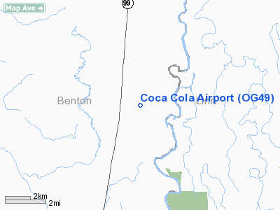
Location & QuickFacts
| FAA Information Effective: | 2008-09-25 |
| Airport Identifier: | OG49 |
| Airport Status: | Operational |
| Longitude/Latitude: | 123-15-32.0000W/44-25-19.0000N
-123.258889/44.421944 (Estimated) |
| Elevation: | 300 ft / 91.44 m () |
| Land: | 15 acres |
| From nearest city: | 0 nautical miles of Corvalis, OR |
| Location: | Benton County, OR |
| Magnetic Variation: | () |
Owner & Manager
| Ownership: | Privately owned |
| Owner: | Michael Lorenzen |
| Address: | 29216 Lakeside Dr
Corvalis, OR 97333 |
| Phone number: | 541-758-7423 |
| Manager: | Michael Lorenzen |
| Address: | 29216 Lakeside Dr
Corvalis, OR 97333 |
| Phone number: | 541-758-7423 |
Airport Operations and Facilities
| Airport Use: | Private |
| Control Tower: | No |
| Sectional chart: | Klamath Falls |
| Region: | ANM - Northwest Mountain |
| Boundary ARTCC: | ZSE - Seattle |
| Tie-in FSS: | MMV - Mc Minnville |
| FSS Toll Free: | 1-800-WX-BRIEF |
Runway Information
Runway 08/26
| Dimension: | 1050 x 25 ft / 320.0 x 7.6 m |
| Surface: | TURF, |
| |
Runway 08 |
Runway 26 |
| Traffic Pattern: | Left | Left |
| Obstruction: | | 32 ft plines, 225.0 ft from runway |
|
Radio Navigation Aids
| ID |
Type |
Name |
Ch |
Freq |
Var |
Dist |
| LWG | NDB | Lewisburg | | 225.00 | 18E | 11.5 nm |
| EU | NDB | Frakk | | 260.00 | 19E | 12.7 nm |
| CVO | VOR/DME | Corvallis | 101X | 115.40 | 18E | 4.9 nm |
| EUG | VORTAC | Eugene | 076X | 112.90 | 20E | 18.2 nm |
| ONP | VORTAC | Newport | 118X | 117.10 | 19E | 35.6 nm |
Images and information placed above are from
http://www.airport-data.com/airport/OG49/
We thank them for the data!
|
|


