 |
|
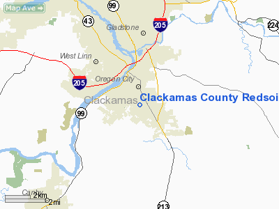
Clackamas County Redsoils Heliport |
Location & QuickFacts
| FAA Information Effective: | 2008-09-25 |
| Airport Identifier: | 1OR8 |
| Airport Status: | Operational |
| Longitude/Latitude: | 122-35-49.3260W/45-20-05.4350N
-122.597035/45.334843 (Estimated) |
| Elevation: | 470 ft / 143.26 m (Estimated) |
| Land: | 1 acres |
| From nearest city: | 0 nautical miles N of Oregon City, OR |
| Location: | Clackamas County, OR |
| Magnetic Variation: | 19E (1985) |
Owner & Manager
| Ownership: | Publicly owned |
| Owner: | County Of Clackamas |
| Address: | 2200 S. Kaen Rd.
Oregon City, OR 97045 |
| Manager: | Casey Marley, Emg Svs |
| Address: | 2200 S. Kaen Rd.
Oregon City, OR 97045 |
| Phone number: | 503-655-8778 |
Airport Operations and Facilities
| Airport Use: | Private |
| Wind indicator: | Yes |
| Segmented Circle: | No |
| Control Tower: | No |
| Landing fee charge: | No |
| Sectional chart: | Seattle |
| Region: | ANM - Northwest Mountain |
| Boundary ARTCC: | ZSE - Seattle |
| Tie-in FSS: | MMV - Mc Minnville |
| FSS on Airport: | No |
| FSS Toll Free: | 1-800-WX-BRIEF |
Airport Services
| Airframe Repair: | NONE |
| Power Plant Repair: | NONE |
Runway Information
Helipad H1
| Dimension: | 270 x 175 ft / 82.3 x 53.3 m |
| Surface: | TURF, |
| |
Runway H1 |
Runway |
| Elevation: | 470.00 ft | 0.00 ft |
| Traffic Pattern: | Left | Left |
| Obstruction: | 90 ft ants, 2000.0 ft from runway | |
|
Radio Navigation Aids
| ID |
Type |
Name |
Ch |
Freq |
Var |
Dist |
| LBH | NDB | Laker | | 332.00 | 20E | 13.6 nm |
| PND | NDB | Banks | | 356.00 | 21E | 25.9 nm |
| CBU | TACAN | Columbia | 029X | | 20E | 15.3 nm |
| PDX | VOR/DME | Portland | 055X | 111.80 | 20E | 15.6 nm |
| UBG | VOR/DME | Newberg | 121X | 117.40 | 21E | 16.1 nm |
| BTG | VORTAC | Battle Ground | 113X | 116.60 | 21E | 24.8 nm |
| PDX | VOT | Portland Intl | | 111.00 | | 15.8 nm |
| HIO | VOT | Portland-hillsboro | | 115.20 | | 19.3 nm |
Remarks
- USE OF HELIPORT RESTRICTED TO CLACKAMAS CO. OFFICIAL BUSINESS.
- PRIM PICKUP PT FOR SHERIFFS DEPT OBSERVERS FLYING WITH OREGON ARNG SEARCH & RESCUE.
Images and information placed above are from
http://www.airport-data.com/airport/1OR8/
We thank them for the data!
| General Info
|
| Country |
United States
|
| State |
OREGON
|
| FAA ID |
1OR8
|
| Latitude |
45-20-05.435N
|
| Longitude |
122-35-49.326W
|
| Elevation |
470 feet
|
| Near City |
OREGON CITY
|
We don't guarantee the information is fresh and accurate. The data may
be wrong or outdated.
For more up-to-date information please refer to other sources.
|
|


