 |
|
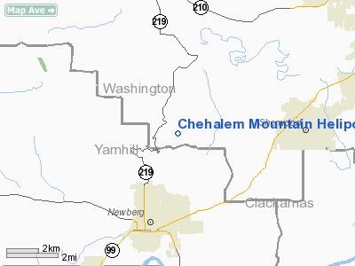
Chehalem Mountain Heliport |
Location & QuickFacts
| FAA Information Effective: | 2008-09-25 |
| Airport Identifier: | 1OR1 |
| Airport Status: | Operational |
| Longitude/Latitude: | 122-56-46.3630W/45-21-19.4230N
-122.946212/45.355395 (Estimated) |
| Elevation: | 900 ft / 274.32 m (Surveyed) |
| Land: | 2 acres |
| From nearest city: | 4 nautical miles N of Newberg, OR |
| Location: | Washington County, OR |
| Magnetic Variation: | 19E (1985) |
Owner & Manager
| Ownership: | Privately owned |
| Owner: | C D James |
| Address: | 26065 Sw Neill Rd
Newberg, OR 97132 |
| Phone number: | 503-628-2758 |
| Manager: | David James |
| Address: | 26065 Sw Neill Rd
Newberg, OR 97132 |
| Phone number: | 503-628-2758 |
Airport Operations and Facilities
| Airport Use: | Private |
| Wind indicator: | Yes |
| Segmented Circle: | No |
| Control Tower: | No |
| Sectional chart: | Seattle |
| Region: | ANM - Northwest Mountain |
| Boundary ARTCC: | ZSE - Seattle |
| Tie-in FSS: | MMV - Mc Minnville |
| FSS Toll Free: | 1-800-WX-BRIEF |
Runway Information
Helipad H1
| Dimension: | 70 x 30 ft / 21.3 x 9.1 m |
| Surface: | CONC, |
| |
Runway H1 |
Runway |
| Traffic Pattern: | Left | Left |
|
Radio Navigation Aids
| ID |
Type |
Name |
Ch |
Freq |
Var |
Dist |
| PND | NDB | Banks | | 356.00 | 21E | 17.0 nm |
| LBH | NDB | Laker | | 332.00 | 20E | 23.3 nm |
| LWG | NDB | Lewisburg | | 225.00 | 18E | 46.7 nm |
| LSO | NDB | Kelso | | 256.00 | 21E | 48.1 nm |
| CBU | TACAN | Columbia | 029X | | 20E | 19.9 nm |
| UBG | VOR/DME | Newberg | 121X | 117.40 | 21E | 1.4 nm |
| PDX | VOR/DME | Portland | 055X | 111.80 | 20E | 20.3 nm |
| BTG | VORTAC | Battle Ground | 113X | 116.60 | 21E | 27.9 nm |
| HIO | VOT | Portland-hillsboro | | 115.20 | | 11.1 nm |
| PDX | VOT | Portland Intl | | 111.00 | | 20.6 nm |
Images and information placed above are from
http://www.airport-data.com/airport/1OR1/
We thank them for the data!
| General Info
|
| Country |
United States
|
| State |
OREGON
|
| FAA ID |
1OR1
|
| Latitude |
45-21-19.423N
|
| Longitude |
122-56-46.363W
|
| Elevation |
900 feet
|
| Near City |
NEWBERG
|
We don't guarantee the information is fresh and accurate. The data may
be wrong or outdated.
For more up-to-date information please refer to other sources.
|
|


