 |
|
| Camp Rilea Heliport |
| IATA: none – ICAO: none – FAA LID: 15OR |
| Summary |
| Airport type |
Military |
| Owner |
Oregon National Guard |
| Location |
Warrenton, Oregon |
| Elevation AMSL |
32 ft / 9 m |
| Coordinates |
46°06′59.3800″N 123°55′53.5150″W / 46.1164944°N 123.93153194°W / 46.1164944; -123.93153194 |
| Helipads |
| Number |
Length |
Surface |
| ft |
m |
| H1 |
60 |
18 |
Turf |
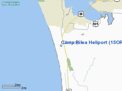
Camp Rilea Heliport (FAA LID: 15OR), is a military heliport located three miles (4.8 km) south of the city of Warrenton in Clatsop County, Oregon, USA.
The above content comes from Wikipedia and is published under free licenses – click here to read more.
Location & QuickFacts
| FAA Information Effective: | 2008-09-25 |
| Airport Identifier: | 15OR |
| Airport Status: | Operational |
| Longitude/Latitude: | 123-55-53.5150W/46-06-59.3800N
-123.931532/46.116494 (Estimated) |
| Elevation: | 32 ft / 9.75 m (Estimated) |
| Land: | 0 acres |
| From nearest city: | 3 nautical miles S of Warrenton, OR |
| Location: | Clatsop County, OR |
| Magnetic Variation: | 20E (1985) |
Owner & Manager
| Ownership: | Publicly owned |
| Owner: | Oregon Army Nat'l Guard |
| Address: | 1776 Militia Way Box 14350
Salem, OR 97309-5047 |
| Phone number: | 503-945-3903 |
| Manager: | Herbert J Sims |
| Address: | 1776 Militia Way Box 14350
Salem, OR 97309-5047 |
| Phone number: | 503-945-3903 |
Airport Operations and Facilities
| Airport Use: | Private |
| Wind indicator: | Yes |
| Segmented Circle: | Yes |
| Control Tower: | No |
| Landing fee charge: | No |
| Sectional chart: | Seattle |
| Region: | ANM - Northwest Mountain |
| Boundary ARTCC: | ZSE - Seattle |
| Tie-in FSS: | MMV - Mc Minnville |
| FSS on Airport: | No |
| FSS Toll Free: | 1-800-WX-BRIEF |
Runway Information
Helipad H1
| Dimension: | 60 x 60 ft / 18.3 x 18.3 m |
| Surface: | TURF, |
| |
Runway H1 |
Runway |
| Traffic Pattern: | Left | Left |
|
Radio Navigation Aids
| ID |
Type |
Name |
Ch |
Freq |
Var |
Dist |
| AST | FAN MARKER | Fort Stevens | | | 22E | 5.7 nm |
| PEN | NDB | Karpen | | 201.00 | 20E | 14.4 nm |
| LSO | NDB | Kelso | | 256.00 | 21E | 42.5 nm |
| PND | NDB | Banks | | 356.00 | 21E | 47.2 nm |
| AST | VOR/DME | Astoria | 087X | 114.00 | 19E | 3.5 nm |
Images and information placed above are from
http://www.airport-data.com/airport/15OR/
We thank them for the data!
| General Info
|
| Country |
United States
|
| State |
OREGON
|
| FAA ID |
15OR
|
| Latitude |
46-06-59.380N
|
| Longitude |
123-55-53.515W
|
| Elevation |
32 feet
|
| Near City |
WARRENTON
|
We don't guarantee the information is fresh and accurate. The data may
be wrong or outdated.
For more up-to-date information please refer to other sources.
|
|


