 |
|
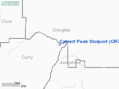
Calvert Peak Stolport Airport |
Location & QuickFacts
| FAA Information Effective: | 2008-09-25 |
| Airport Identifier: | OR73 |
| Airport Status: | Operational |
| Longitude/Latitude: | 123-44-02.2850W/42-46-43.4070N
-123.733968/42.778724 (Estimated) |
| Elevation: | 3808 ft / 1160.68 m (Surveyed) |
| Land: | 0 acres |
| From nearest city: | 14 nautical miles W of Glendale, OR |
| Location: | Curry County, OR |
| Magnetic Variation: | 18E (1985) |
Owner & Manager
| Ownership: | Publicly owned |
| Owner: | Bureau Of Land Mngmnt |
| Address: | 3040 Biddle Road
Medford, OR 97504 |
| Phone number: | 503-770-2242 |
| Manager: | Mitch Maycox |
| Address: | 3040 Biddle Road
Medford, OR 97504 |
| Phone number: | 503-770-2241 |
Airport Operations and Facilities
| Airport Use: | Private |
| Wind indicator: | Yes |
| Segmented Circle: | No |
| Control Tower: | No |
| Landing fee charge: | No |
| Sectional chart: | Klamath Falls |
| Region: | ANM - Northwest Mountain |
| Boundary ARTCC: | ZSE - Seattle |
| Tie-in FSS: | MMV - Mc Minnville |
| FSS on Airport: | No |
| FSS Toll Free: | 1-800-WX-BRIEF |
Airport Services
| Airframe Repair: | NONE |
| Power Plant Repair: | NONE |
Runway Information
Runway NE/SW
| Dimension: | 1627 x 120 ft / 495.9 x 36.6 m |
| Surface: | ASPH, |
| |
Runway NE |
Runway SW |
| Traffic Pattern: | Left | Left |
|
Radio Navigation Aids
| ID |
Type |
Name |
Ch |
Freq |
Var |
Dist |
| RBG | NDB | Roseburg | | 400.00 | 20E | 32.0 nm |
| MEF | NDB | Medford | | 356.00 | 19E | 44.4 nm |
| RBG | VOR/DME | Roseburg | 019X | 108.20 | 20E | 29.5 nm |
| OED | VORTAC | Rogue Valley | 083X | 113.60 | 19E | 40.5 nm |
| OTH | VORTAC | North Bend | 058X | 112.10 | 18E | 42.8 nm |
| MFR | VOT | Medford-jackson County | | 117.20 | | 46.0 nm |
Remarks
- EMERG & FIRE SUPPRESSION AIRSTRIP.
- THIS AIRSTRIP FOR USE OF BLM ONLY.
- NO OBJECTION PRVDD ARPT IS LIMITED TO PVT USE, VFR DALGT OPNS ONLY.
Images and information placed above are from
http://www.airport-data.com/airport/OR73/
We thank them for the data!
| General Info
|
| Country |
United States
|
| State |
OREGON
|
| FAA ID |
OR73
|
| Latitude |
42-46-43.407N
|
| Longitude |
123-44-02.285W
|
| Elevation |
3808 feet
|
| Near City |
GLENDALE
|
We don't guarantee the information is fresh and accurate. The data may
be wrong or outdated.
For more up-to-date information please refer to other sources.
|
|


