 |
|
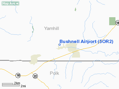
Location & QuickFacts
| FAA Information Effective: | 2008-09-25 |
| Airport Identifier: | 5OR2 |
| Airport Status: | Operational |
| Longitude/Latitude: | 123-25-29.3860W/45-06-11.4110N
-123.424829/45.103170 (Estimated) |
| Elevation: | 220 ft / 67.06 m (Estimated) |
| Land: | 0 acres |
| From nearest city: | 1 nautical miles W of Sheridan, OR |
| Location: | Yamhill County, OR |
| Magnetic Variation: | 19E (1985) |
Owner & Manager
| Ownership: | Privately owned |
| Owner: | Robert D Bushnell |
| Address: | 7715 N. Bank
Portland, OR 97203 |
| Address: |
|
Airport Operations and Facilities
| Airport Use: | Private |
| Wind indicator: | No |
| Segmented Circle: | No |
| Control Tower: | No |
| Landing fee charge: | No |
| Sectional chart: | Seattle |
| Region: | ANM - Northwest Mountain |
| Boundary ARTCC: | ZSE - Seattle |
| Tie-in FSS: | MMV - Mc Minnville |
| FSS on Airport: | No |
| FSS Toll Free: | 1-800-WX-BRIEF |
Airport Services
| Airframe Repair: | NONE |
| Power Plant Repair: | NONE |
Runway Information
Runway 07/25
| Dimension: | 1450 x 50 ft / 442.0 x 15.2 m |
| Surface: | TURF, |
| |
Runway 07 |
Runway 25 |
| Traffic Pattern: | Left | Right |
|
Radio Navigation Aids
| ID |
Type |
Name |
Ch |
Freq |
Var |
Dist |
| LWG | NDB | Lewisburg | | 225.00 | 18E | 30.2 nm |
| PND | NDB | Banks | | 356.00 | 21E | 35.5 nm |
| LBH | NDB | Laker | | 332.00 | 20E | 48.5 nm |
| CBU | TACAN | Columbia | 029X | | 20E | 45.1 nm |
| UBG | VOR/DME | Newberg | 121X | 117.40 | 21E | 24.2 nm |
| CVO | VOR/DME | Corvallis | 101X | 115.40 | 18E | 36.7 nm |
| PDX | VOR/DME | Portland | 055X | 111.80 | 20E | 45.4 nm |
| ONP | VORTAC | Newport | 118X | 117.10 | 19E | 41.7 nm |
| HIO | VOT | Portland-hillsboro | | 115.20 | | 33.1 nm |
| PDX | VOT | Portland Intl | | 111.00 | | 45.8 nm |
Remarks
- NO OBJECTION PRVDG SHERIDAN ARPT IS CLOSED.
Images and information placed above are from
http://www.airport-data.com/airport/5OR2/
We thank them for the data!
| General Info
|
| Country |
United States
|
| State |
OREGON
|
| FAA ID |
5OR2
|
| Latitude |
45-06-11.411N
|
| Longitude |
123-25-29.386W
|
| Elevation |
220 feet
|
| Near City |
SHERIDAN
|
We don't guarantee the information is fresh and accurate. The data may
be wrong or outdated.
For more up-to-date information please refer to other sources.
|
|


