 |
|
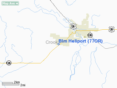
Location & QuickFacts
| FAA Information Effective: | 2008-09-25 |
| Airport Identifier: | 77OR |
| Airport Status: | Operational |
| Longitude/Latitude: | 120-54-06.0840W/44-16-47.4490N
-120.901690/44.279847 (Estimated) |
| Elevation: | 3250 ft / 990.60 m (Estimated) |
| Land: | 1 acres |
| From nearest city: | 3 nautical miles SW of Prineville, OR |
| Location: | Crook County, OR |
| Magnetic Variation: | 19E (1980) |
Owner & Manager
| Ownership: | Publicly owned |
| Owner: | Crook County |
| Address: | County Court House
Prineville, OR 97754 |
| Phone number: | 503-447-6555 |
| Manager: | Blm District Manager |
| Address: | Po Box 550
Prineville, OR 97754 |
| Phone number: | 503-447-4115 |
Airport Operations and Facilities
| Airport Use: | Private |
| Wind indicator: | Yes |
| Segmented Circle: | No |
| Control Tower: | No |
| Sectional chart: | Klamath Falls |
| Region: | ANM - Northwest Mountain |
| Boundary ARTCC: | ZSE - Seattle |
| Tie-in FSS: | MMV - Mc Minnville |
| FSS Toll Free: | 1-800-WX-BRIEF |
Runway Information
Helipad H1
| Dimension: | 20 x 20 ft / 6.1 x 6.1 m |
| Surface: | CONC, |
| |
Runway H1 |
Runway |
| Traffic Pattern: | Left | Left |
|
Radio Navigation Aids
| ID |
Type |
Name |
Ch |
Freq |
Var |
Dist |
| RD | NDB | Bodey | | 411.00 | 18E | 5.3 nm |
| DSD | VORTAC | Deschutes | 123X | 117.60 | 18E | 17.4 nm |
Remarks
- HELIPORT LCTD IMMEDIATELY ADJ TO PRINEVILLE-CROOK COUNTY ARPT NEAR S END RY 33.
Images and information placed above are from
http://www.airport-data.com/airport/77OR/
We thank them for the data!
| General Info
|
| Country |
United States
|
| State |
OREGON
|
| FAA ID |
77OR
|
| Latitude |
44-16-47.449N
|
| Longitude |
120-54-06.084W
|
| Elevation |
3250 feet
|
| Near City |
PRINEVILLE
|
We don't guarantee the information is fresh and accurate. The data may
be wrong or outdated.
For more up-to-date information please refer to other sources.
|
|


